

5 Cáceres Salamanca
A cycling route starting in Plasencia, Extremadura, Spain.
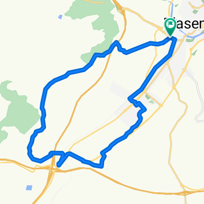
Overview
About this route
Plasencia - Valdeobispo - Santibañez de Abajo - Guijo de Granadilla - Mohedas - Casar de Palomero - Caminomorisco - Vegas de Coria - Rebollosa - Herguijuela de la Sierra - Madroñal - Puerto del Portillo (via Rebollosa to La Alberca) - La Alberca
- -:--
- Duration
- 99.1 km
- Distance
- 1,503 m
- Ascent
- 812 m
- Descent
- ---
- Avg. speed
- ---
- Max. altitude
Route quality
Waytypes & surfaces along the route
Waytypes
Road
40.6 km
(41 %)
Quiet road
4 km
(4 %)
Surfaces
Paved
47.6 km
(48 %)
Asphalt
40.6 km
(41 %)
Paved (undefined)
6.9 km
(7 %)
Undefined
51.5 km
(52 %)
Continue with Bikemap
Use, edit, or download this cycling route
You would like to ride 5 Cáceres Salamanca or customize it for your own trip? Here is what you can do with this Bikemap route:
Free features
- Save this route as favorite or in collections
- Copy & plan your own version of this route
- Split it into stages to create a multi-day tour
- Sync your route with Garmin or Wahoo
Premium features
Free trial for 3 days, or one-time payment. More about Bikemap Premium.
- Navigate this route on iOS & Android
- Export a GPX / KML file of this route
- Create your custom printout (try it for free)
- Download this route for offline navigation
Discover more Premium features.
Get Bikemap PremiumFrom our community
Other popular routes starting in Plasencia
 Plasencia - Cáceres por Via de la Plata
- Distance
- 87.2 km
- Ascent
- 721 m
- Descent
- 667 m
- Location
- Plasencia, Extremadura, Spain
 Vuelta al Merengue
- Distance
- 19.8 km
- Ascent
- 395 m
- Descent
- 390 m
- Location
- Plasencia, Extremadura, Spain
 Gredos y Peña de Francia 2013
- Distance
- 621.8 km
- Ascent
- 3,763 m
- Descent
- 3,763 m
- Location
- Plasencia, Extremadura, Spain
 Vuelta al Pantano del Jerte
- Distance
- 41.1 km
- Ascent
- 363 m
- Descent
- 362 m
- Location
- Plasencia, Extremadura, Spain
 Puertos del Valle
- Distance
- 215.3 km
- Ascent
- 4,617 m
- Descent
- 2,995 m
- Location
- Plasencia, Extremadura, Spain
 Plasencia - Embalse de Torrejón (Monfragüe)
- Distance
- 34 km
- Ascent
- 438 m
- Descent
- 539 m
- Location
- Plasencia, Extremadura, Spain
 Subida a la Ermita
- Distance
- 16.2 km
- Ascent
- 365 m
- Descent
- 369 m
- Location
- Plasencia, Extremadura, Spain
 Tramo 1 ruta Circular Plasencia
- Distance
- 16.3 km
- Ascent
- 246 m
- Descent
- 223 m
- Location
- Plasencia, Extremadura, Spain
Open it in the app