

E-bike-routenBergisch2-AufJaegersPfaden
A cycling route starting in Much, North Rhine-Westphalia, Germany.
Overview
About this route
Track origin: © Bielefelder Verlag, cycling map Rhein-Sieg, 2015
- -:--
- Duration
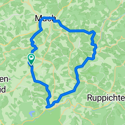
- 35.1 km
- Distance
- 405 m
- Ascent
- 403 m
- Descent
- ---
- Avg. speed
- ---
- Max. altitude

Route quality
Waytypes & surfaces along the route
Waytypes
Quiet road
15.4 km
(44 %)
Road
5.3 km
(15 %)
Surfaces
Paved
19.7 km
(56 %)
Unpaved
3.5 km
(10 %)
Asphalt
19.7 km
(56 %)
Gravel
1.8 km
(5 %)
Continue with Bikemap
Use, edit, or download this cycling route
You would like to ride E-bike-routenBergisch2-AufJaegersPfaden or customize it for your own trip? Here is what you can do with this Bikemap route:
Free features
- Save this route as favorite or in collections
- Copy & plan your own version of this route
- Sync your route with Garmin or Wahoo
Premium features
Free trial for 3 days, or one-time payment. More about Bikemap Premium.
- Navigate this route on iOS & Android
- Export a GPX / KML file of this route
- Create your custom printout (try it for free)
- Download this route for offline navigation
Discover more Premium features.
Get Bikemap PremiumFrom our community
Other popular routes starting in Much
 Much Scheid nach Immen 25, Wiehl
- Distance
- 13.4 km
- Ascent
- 239 m
- Descent
- 128 m
- Location
- Much, North Rhine-Westphalia, Germany
 2020-08-29: Denklingen - Leuscheid
- Distance
- 84.3 km
- Ascent
- 914 m
- Descent
- 917 m
- Location
- Much, North Rhine-Westphalia, Germany
 2025_08_EinkaufsrundeMuch-Eichhof
- Distance
- 26.1 km
- Ascent
- 424 m
- Descent
- 426 m
- Location
- Much, North Rhine-Westphalia, Germany
 E-bike-routenBergisch2-AufJaegersPfaden
- Distance
- 35.1 km
- Ascent
- 405 m
- Descent
- 403 m
- Location
- Much, North Rhine-Westphalia, Germany
 2025_04_26_nach Kurtenbach, feines Sonntagstouerchen mit Lisa
- Distance
- 33.8 km
- Ascent
- 517 m
- Descent
- 513 m
- Location
- Much, North Rhine-Westphalia, Germany
 2022_09_11^Wanderung Wennbach zur Mündung und zur Quelle zurück
- Distance
- 13.5 km
- Ascent
- 214 m
- Descent
- 213 m
- Location
- Much, North Rhine-Westphalia, Germany
 Much-Sulzdorf
- Distance
- 440.5 km
- Ascent
- 394 m
- Descent
- 355 m
- Location
- Much, North Rhine-Westphalia, Germany
 MTB - zur Sieg
- Distance
- 36.7 km
- Ascent
- 688 m
- Descent
- 688 m
- Location
- Much, North Rhine-Westphalia, Germany
Open it in the app