

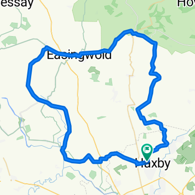
Beadale 100k
A cycling route starting in Wigginton, England, United Kingdom.
Overview
About this route
Flat & fast Wigginton -Beadale Out & home
- -:--
- Duration
- 108.8 km
- Distance
- 113 m
- Ascent
- 111 m
- Descent
- ---
- Avg. speed
- ---
- Max. altitude
Route quality
Waytypes & surfaces along the route
Waytypes
Road
77 km
(71 %)
Busy road
22.3 km
(20 %)
Surfaces
Paved
25.7 km
(24 %)
Unpaved
0.3 km
(<1 %)
Asphalt
25.7 km
(24 %)
Gravel
0.3 km
(<1 %)
Undefined
82.8 km
(76 %)
Continue with Bikemap
Use, edit, or download this cycling route
You would like to ride Beadale 100k or customize it for your own trip? Here is what you can do with this Bikemap route:
Free features
- Save this route as favorite or in collections
- Copy & plan your own version of this route
- Split it into stages to create a multi-day tour
- Sync your route with Garmin or Wahoo
Premium features
Free trial for 3 days, or one-time payment. More about Bikemap Premium.
- Navigate this route on iOS & Android
- Export a GPX / KML file of this route
- Create your custom printout (try it for free)
- Download this route for offline navigation
Discover more Premium features.
Get Bikemap PremiumFrom our community
Other popular routes starting in Wigginton
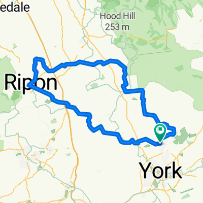
 3 abbeys
- Distance
- 103.7 km
- Ascent
- 388 m
- Descent
- 391 m
- Location
- Wigginton, England, United Kingdom
 Wiggy 60k
- Distance
- 58.6 km
- Ascent
- 131 m
- Descent
- 131 m
- Location
- Wigginton, England, United Kingdom
 Wiggy 60k V3
- Distance
- 58.8 km
- Ascent
- 142 m
- Descent
- 143 m
- Location
- Wigginton, England, United Kingdom
 Moderate route in United Kingdom
- Distance
- 13.6 km
- Ascent
- 38 m
- Descent
- 20 m
- Location
- Wigginton, England, United Kingdom
 Beadale 100k
- Distance
- 108.8 km
- Ascent
- 113 m
- Descent
- 111 m
- Location
- Wigginton, England, United Kingdom
 Wiggly Spring 100km
- Distance
- 103.2 km
- Ascent
- 264 m
- Descent
- 265 m
- Location
- Wigginton, England, United Kingdom
 Wiggy 100km 2023
- Distance
- 102.6 km
- Ascent
- 640 m
- Descent
- 642 m
- Location
- Wigginton, England, United Kingdom
 FriBBridge
- Distance
- 70.2 km
- Ascent
- 81 m
- Descent
- 81 m
- Location
- Wigginton, England, United Kingdom
Open it in the app