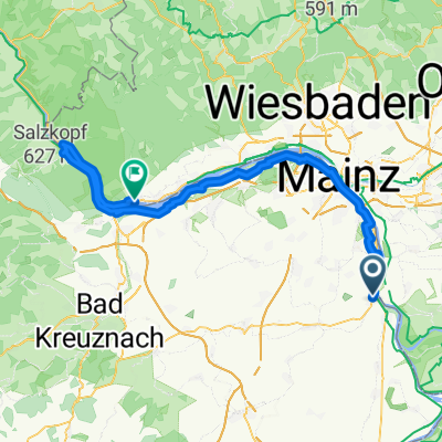
Nierstein - Kühkopf -Eich -Nierstein
A cycling route starting in Nierstein, Rhineland-Palatinate, Germany.
Overview
About this route
- -:--
- Duration
- 49.9 km
- Distance
- 43 m
- Ascent
- 46 m
- Descent
- ---
- Avg. speed
- ---
- Avg. speed
Route quality
Waytypes & surfaces along the route
Waytypes
Track
19.7 km
(40 %)
Quiet road
9.5 km
(19 %)
Surfaces
Paved
35.5 km
(71 %)
Unpaved
9.5 km
(19 %)
Asphalt
21.9 km
(44 %)
Paved (undefined)
7.9 km
(16 %)
Continue with Bikemap
Use, edit, or download this cycling route
You would like to ride Nierstein - Kühkopf -Eich -Nierstein or customize it for your own trip? Here is what you can do with this Bikemap route:
Free features
- Save this route as favorite or in collections
- Copy & plan your own version of this route
- Sync your route with Garmin or Wahoo
Premium features
Free trial for 3 days, or one-time payment. More about Bikemap Premium.
- Navigate this route on iOS & Android
- Export a GPX / KML file of this route
- Create your custom printout (try it for free)
- Download this route for offline navigation
Discover more Premium features.
Get Bikemap PremiumFrom our community
Other popular routes starting in Nierstein
- Durch die Weinberge oppenheim Nierstein
- Distance
- 8.2 km
- Ascent
- 114 m
- Descent
- 117 m
- Location
- Nierstein, Rhineland-Palatinate, Germany
- Nierstein - Kühkopf -Eich -Nierstein
- Distance
- 49.9 km
- Ascent
- 43 m
- Descent
- 46 m
- Location
- Nierstein, Rhineland-Palatinate, Germany
- Rheinhänge Oppenh Guntersbl
- Distance
- 22.5 km
- Ascent
- 346 m
- Descent
- 346 m
- Location
- Nierstein, Rhineland-Palatinate, Germany
- 1990_Glan - Nahe - Rhein (Nierstein - Alzey - Meisenheim - Bad Münster am Stein - Bingen - Mainz-Kastel - Biebesheim)
- Distance
- 210.1 km
- Ascent
- 1,865 m
- Descent
- 1,866 m
- Location
- Nierstein, Rhineland-Palatinate, Germany
- Bildstockstraße, Nierstein nach Marktplatz, Udenheim
- Distance
- 29 km
- Ascent
- 202 m
- Descent
- 154 m
- Location
- Nierstein, Rhineland-Palatinate, Germany
- Moselradweg Teil 2
- Distance
- 301.9 km
- Ascent
- 152 m
- Descent
- 61 m
- Location
- Nierstein, Rhineland-Palatinate, Germany
- Route im Schneckentempo in Trebur
- Distance
- 5.8 km
- Ascent
- 0 m
- Descent
- 4 m
- Location
- Nierstein, Rhineland-Palatinate, Germany
- Route ab Nierstein
- Distance
- 43.1 km
- Ascent
- 221 m
- Descent
- 221 m
- Location
- Nierstein, Rhineland-Palatinate, Germany
Open it in the app