

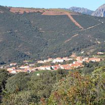
El Hoyo
El Hoyo - Pintillo - Centenillo
A cycling route starting in San Lorenzo de Calatrava, Castille-La Mancha, Spain.
Overview
About this route
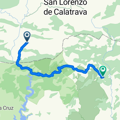
El Hoyo - El Centenillo (via El Pintillo)
- -:--
- Duration
- 34.6 km
- Distance
- 736 m
- Ascent
- 394 m
- Descent
- ---
- Avg. speed
- ---
- Max. altitude

Part of
El Hoyo
8 stages
Route quality
Waytypes & surfaces along the route
Waytypes
Quiet road
15.9 km
(46 %)
Track
15.2 km
(44 %)
Surfaces
Paved
4.2 km
(12 %)
Unpaved
8.7 km
(25 %)
Gravel
8.7 km
(25 %)
Asphalt
4.2 km
(12 %)
Undefined
21.8 km
(63 %)
Continue with Bikemap
Use, edit, or download this cycling route
You would like to ride El Hoyo - Pintillo - Centenillo or customize it for your own trip? Here is what you can do with this Bikemap route:
Free features
- Save this route as favorite or in collections
- Copy & plan your own version of this route
- Sync your route with Garmin or Wahoo
Premium features
Free trial for 3 days, or one-time payment. More about Bikemap Premium.
- Navigate this route on iOS & Android
- Export a GPX / KML file of this route
- Create your custom printout (try it for free)
- Download this route for offline navigation
Discover more Premium features.
Get Bikemap PremiumFrom our community
Other popular routes starting in San Lorenzo de Calatrava
 Valencia - Jaén - Ciudad Real. Etapa 12.
- Distance
- 64 km
- Ascent
- 331 m
- Descent
- 461 m
- Location
- San Lorenzo de Calatrava, Castille-La Mancha, Spain
 El Hoyo - Pintillo - Centenillo
- Distance
- 34.6 km
- Ascent
- 736 m
- Descent
- 394 m
- Location
- San Lorenzo de Calatrava, Castille-La Mancha, Spain
 El Centenillo
- Distance
- 34.3 km
- Ascent
- 771 m
- Descent
- 443 m
- Location
- San Lorenzo de Calatrava, Castille-La Mancha, Spain
 81 San Lorenzo - Virgen la Cabeza
- Distance
- 71.6 km
- Ascent
- 970 m
- Descent
- 1,102 m
- Location
- San Lorenzo de Calatrava, Castille-La Mancha, Spain
 El Hoyo - Pintillo - Centenillo - Vuelta por Finca
- Distance
- 60 km
- Ascent
- 1,061 m
- Descent
- 1,061 m
- Location
- San Lorenzo de Calatrava, Castille-La Mancha, Spain
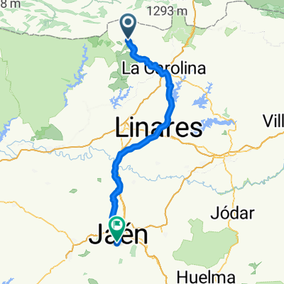 San Lorenzo de Calatrava - Jaén
- Distance
- 99.3 km
- Ascent
- 413 m
- Descent
- 650 m
- Location
- San Lorenzo de Calatrava, Castille-La Mancha, Spain
 El Hoyo - San Lorenzo - El Centenillo
- Distance
- 53.1 km
- Ascent
- 1,089 m
- Descent
- 750 m
- Location
- San Lorenzo de Calatrava, Castille-La Mancha, Spain
 COLLADO PISA, por Garganta del Montoro
- Distance
- 18.9 km
- Ascent
- 806 m
- Descent
- 264 m
- Location
- San Lorenzo de Calatrava, Castille-La Mancha, Spain
Open it in the app