

Teufelsfelsen_Lengfeld
A cycling route starting in Rohr, Bavaria, Germany.
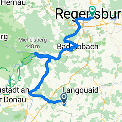
Overview
About this route
Adlhausen
Race track to Herrnwahlthann
Buch
Oberfecking
over the lime works
Teufelsfelsen/Allkofen
Golf course
Lengfeld/Teugn
Tronholzen/Weilhof
Saalhaupt/motorway
Oberschneidhart
Fischerbräu cave
English greeting/13 towers view
Adlhausen
- -:--
- Duration
- 51.4 km
- Distance
- 619 m
- Ascent
- 615 m
- Descent
- ---
- Avg. speed
- ---
- Max. altitude

Route quality
Waytypes & surfaces along the route
Waytypes
Track
41.1 km
(80 %)
Quiet road
4.6 km
(9 %)
Surfaces
Paved
5.7 km
(11 %)
Unpaved
37 km
(72 %)
Gravel
16.5 km
(32 %)
Ground
14.4 km
(28 %)
Continue with Bikemap
Use, edit, or download this cycling route
You would like to ride Teufelsfelsen_Lengfeld or customize it for your own trip? Here is what you can do with this Bikemap route:
Free features
- Save this route as favorite or in collections
- Copy & plan your own version of this route
- Sync your route with Garmin or Wahoo
Premium features
Free trial for 3 days, or one-time payment. More about Bikemap Premium.
- Navigate this route on iOS & Android
- Export a GPX / KML file of this route
- Create your custom printout (try it for free)
- Download this route for offline navigation
Discover more Premium features.
Get Bikemap PremiumFrom our community
Other popular routes starting in Rohr
 Teufelsfelsen_Lengfeld
- Distance
- 51.4 km
- Ascent
- 619 m
- Descent
- 615 m
- Location
- Rohr, Bavaria, Germany
 2016.08.2016_Adlhausen - Sandharlanden
- Distance
- 48.5 km
- Ascent
- 306 m
- Descent
- 306 m
- Location
- Rohr, Bavaria, Germany
 Pattendorf-Rohr-Helchenbach
- Distance
- 45.1 km
- Ascent
- 363 m
- Descent
- 362 m
- Location
- Rohr, Bavaria, Germany
 Mannsdorf
- Distance
- 43.2 km
- Ascent
- 392 m
- Descent
- 392 m
- Location
- Rohr, Bavaria, Germany
 2016.04.15_Adlhausen-Abensberg_OBI-Cup
- Distance
- 48.9 km
- Ascent
- 243 m
- Descent
- 243 m
- Location
- Rohr, Bavaria, Germany
 Robert Silke Radln Tag 1 Asbach-Regensburg
- Distance
- 69.1 km
- Ascent
- 340 m
- Descent
- 424 m
- Location
- Rohr, Bavaria, Germany
 Oberhaselbach-Oberndorf-Birnbach
- Distance
- 48.3 km
- Ascent
- 571 m
- Descent
- 582 m
- Location
- Rohr, Bavaria, Germany
 2016.05.03_Adlhausen_Fischerbräu-Grub-Obereichet
- Distance
- 29.4 km
- Ascent
- 259 m
- Descent
- 251 m
- Location
- Rohr, Bavaria, Germany
Open it in the app