

1. Etappe Breitenbach -Oberhof
A cycling route starting in Breitenbach, Hesse, Germany.
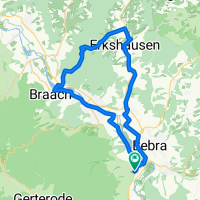
Overview
About this route
The route mostly runs on low-traffic secondary roads. Only at the end of the stage towards Tambach-Dietharz do we follow the unpaved Rennsteig. Suddenly, at Grenzadler, we hit the paved road to Oberhof.
- -:--
- Duration
- 114.1 km
- Distance
- 1,469 m
- Ascent
- 1,027 m
- Descent
- ---
- Avg. speed
- 707 m
- Max. altitude

Route quality
Waytypes & surfaces along the route
Waytypes
Track
26.2 km
(23 %)
Quiet road
14.8 km
(13 %)
Surfaces
Paved
69.6 km
(61 %)
Unpaved
12.5 km
(11 %)
Asphalt
69.6 km
(61 %)
Gravel
9.1 km
(8 %)
Continue with Bikemap
Use, edit, or download this cycling route
You would like to ride 1. Etappe Breitenbach -Oberhof or customize it for your own trip? Here is what you can do with this Bikemap route:
Free features
- Save this route as favorite or in collections
- Copy & plan your own version of this route
- Split it into stages to create a multi-day tour
- Sync your route with Garmin or Wahoo
Premium features
Free trial for 3 days, or one-time payment. More about Bikemap Premium.
- Navigate this route on iOS & Android
- Export a GPX / KML file of this route
- Create your custom printout (try it for free)
- Download this route for offline navigation
Discover more Premium features.
Get Bikemap PremiumFrom our community
Other popular routes starting in Breitenbach
 Durch Waldhessen II
- Distance
- 66.1 km
- Ascent
- 852 m
- Descent
- 852 m
- Location
- Breitenbach, Hesse, Germany
 Bad Hersfeld auf neuen Wegen
- Distance
- 67.4 km
- Ascent
- 618 m
- Descent
- 612 m
- Location
- Breitenbach, Hesse, Germany
 über die Hohe Buche (Waldhessen)
- Distance
- 32.4 km
- Ascent
- 334 m
- Descent
- 334 m
- Location
- Breitenbach, Hesse, Germany
 Friedewaldtour 2019
- Distance
- 37.5 km
- Ascent
- 376 m
- Descent
- 375 m
- Location
- Breitenbach, Hesse, Germany
 Hessentour 1990
- Distance
- 799.1 km
- Ascent
- 2,820 m
- Descent
- 2,818 m
- Location
- Breitenbach, Hesse, Germany
 Von Breitenbach in die Rhön
- Distance
- 79.2 km
- Ascent
- 424 m
- Descent
- 424 m
- Location
- Breitenbach, Hesse, Germany
 Über den Alheimer
- Distance
- 33.1 km
- Ascent
- 484 m
- Descent
- 485 m
- Location
- Breitenbach, Hesse, Germany
 1. Etappe Breitenbach -Oberhof
- Distance
- 114.1 km
- Ascent
- 1,469 m
- Descent
- 1,027 m
- Location
- Breitenbach, Hesse, Germany
Open it in the app