

KM 19-TOCOTA-JORDAN-QUEREMAL
A cycling route starting in Santiago de Cali, Valle del Cauca Department, Colombia.
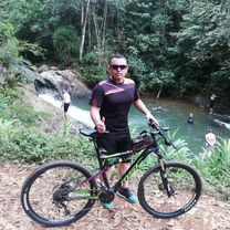
Overview
About this route
1)KM 19-LOMA ALTA-TOCOTA (DERECHA-IZQUIERDA HASTA LA MITAD)
-
TOCOTA- JORDANCITO- JORDAN (MITAD- HACIA LA IZQUIERDA)
-
JORDAN- ROSITA MACHADO-SENDO- QUEREMAL
- -:--
- Duration
- 26.1 km
- Distance
- 765 m
- Ascent
- 1,187 m
- Descent
- ---
- Avg. speed
- ---
- Max. altitude

Continue with Bikemap
Use, edit, or download this cycling route
You would like to ride KM 19-TOCOTA-JORDAN-QUEREMAL or customize it for your own trip? Here is what you can do with this Bikemap route:
Free features
- Save this route as favorite or in collections
- Copy & plan your own version of this route
- Sync your route with Garmin or Wahoo
Premium features
Free trial for 3 days, or one-time payment. More about Bikemap Premium.
- Navigate this route on iOS & Android
- Export a GPX / KML file of this route
- Create your custom printout (try it for free)
- Download this route for offline navigation
Discover more Premium features.
Get Bikemap PremiumFrom our community
Other popular routes starting in Santiago de Cali
 Ciudad Jardin-Alfaguara
- Distance
- 28.3 km
- Ascent
- 147 m
- Descent
- 147 m
- Location
- Santiago de Cali, Valle del Cauca Department, Colombia
 De Carrera 34 15-66, Cali a Carrera 34 15-66, Cali
- Distance
- 45.7 km
- Ascent
- 639 m
- Descent
- 634 m
- Location
- Santiago de Cali, Valle del Cauca Department, Colombia
 Raíces, postes y mirador
- Distance
- 18.2 km
- Ascent
- 558 m
- Descent
- 563 m
- Location
- Santiago de Cali, Valle del Cauca Department, Colombia
 De Carrera 34 15-65, Cali a Calle 16 34-32, Cali
- Distance
- 50.4 km
- Ascent
- 451 m
- Descent
- 448 m
- Location
- Santiago de Cali, Valle del Cauca Department, Colombia
 De Carrera 66 1311, Cali a Carrera 53 #5B-66, Cali
- Distance
- 32.5 km
- Ascent
- 647 m
- Descent
- 651 m
- Location
- Santiago de Cali, Valle del Cauca Department, Colombia
 De Carrera 34 15-66, Cali a Carrera 34 15-68, Cali
- Distance
- 48.7 km
- Ascent
- 349 m
- Descent
- 344 m
- Location
- Santiago de Cali, Valle del Cauca Department, Colombia
 bosque el descanso
- Distance
- 51.8 km
- Ascent
- 1,216 m
- Descent
- 1,209 m
- Location
- Santiago de Cali, Valle del Cauca Department, Colombia
 El minuto
- Distance
- 32.1 km
- Ascent
- 634 m
- Descent
- 633 m
- Location
- Santiago de Cali, Valle del Cauca Department, Colombia
Open it in the app