

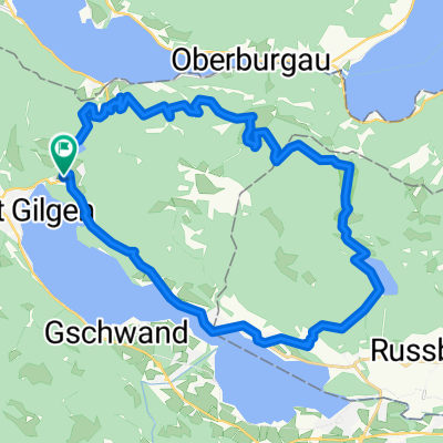
Salzburgerland'16/Etappe1: St. Gilgen am Wolfgangsee - Bad Ischl - Pötschenhöhe - Altaussee - Loseralm-Panoramastr. - Bad Aussee - Koppen-Pass - Hallstatter See
A cycling route starting in St. Gilgen, Salzburg, Austria.
Overview
About this route
with Andy + Domi from Wolfgangsee over the Pötschenhöhe to the magnificent Loser panoramic road
- -:--
- Duration
- 137.6 km
- Distance
- 1,515 m
- Ascent
- 1,497 m
- Descent
- ---
- Avg. speed
- ---
- Max. altitude

Route quality
Waytypes & surfaces along the route
Waytypes
Quiet road
34.4 km
(25 %)
Path
13.8 km
(10 %)
Surfaces
Paved
118.3 km
(86 %)
Unpaved
6.9 km
(5 %)
Asphalt
115.6 km
(84 %)
Gravel
5.5 km
(4 %)
Continue with Bikemap
Use, edit, or download this cycling route
You would like to ride Salzburgerland'16/Etappe1: St. Gilgen am Wolfgangsee - Bad Ischl - Pötschenhöhe - Altaussee - Loseralm-Panoramastr. - Bad Aussee - Koppen-Pass - Hallstatter See or customize it for your own trip? Here is what you can do with this Bikemap route:
Free features
- Save this route as favorite or in collections
- Copy & plan your own version of this route
- Split it into stages to create a multi-day tour
- Sync your route with Garmin or Wahoo
Premium features
Free trial for 3 days, or one-time payment. More about Bikemap Premium.
- Navigate this route on iOS & Android
- Export a GPX / KML file of this route
- Create your custom printout (try it for free)
- Download this route for offline navigation
Discover more Premium features.
Get Bikemap PremiumFrom our community
Other popular routes starting in St. Gilgen
 Ein Mal um den Schafberg_Schwarzensee- Wolfgangsee- Eisenaueralm CLONED FROM ROUTE 1712510
- Distance
- 31.7 km
- Ascent
- 1,101 m
- Descent
- 1,102 m
- Location
- St. Gilgen, Salzburg, Austria
 Salzkammergut Tour 3
- Distance
- 80.1 km
- Ascent
- 354 m
- Descent
- 354 m
- Location
- St. Gilgen, Salzburg, Austria
 Around.Wolfgansee.Schwarzensee
- Distance
- 42.1 km
- Ascent
- 640 m
- Descent
- 640 m
- Location
- St. Gilgen, Salzburg, Austria
 12er down
- Distance
- 15.4 km
- Ascent
- 268 m
- Descent
- 1,165 m
- Location
- St. Gilgen, Salzburg, Austria
 Tiefbrunnau - 12er Horn - St. Gilgen - Fuschl -Tiefbrunnau
- Distance
- 37.1 km
- Ascent
- 1,234 m
- Descent
- 1,233 m
- Location
- St. Gilgen, Salzburg, Austria
 🚴♀️E*Bike🇦🇹 St. Gilgen-Wolfgangsee-Attersee-Mondsee ü.Mosalm✅
- Distance
- 44.1 km
- Ascent
- 894 m
- Descent
- 893 m
- Location
- St. Gilgen, Salzburg, Austria
 Zwölferhorn
- Distance
- 32.6 km
- Ascent
- 1,261 m
- Descent
- 1,262 m
- Location
- St. Gilgen, Salzburg, Austria
 Lange Radrunde durch Sankt Gilgen
- Distance
- 62.9 km
- Ascent
- 314 m
- Descent
- 314 m
- Location
- St. Gilgen, Salzburg, Austria
Open it in the app