

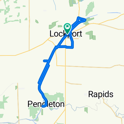
Lockport 1975 Along the Canal of the 1800s
A cycling route starting in Lockport, New York, United States.
Overview
About this route
Road bike, fairly flat, route goes with the Lockport YWCA Canal Tour of 1975
- -:--
- Duration
- 34.8 km
- Distance
- 92 m
- Ascent
- 94 m
- Descent
- ---
- Avg. speed
- ---
- Max. altitude

Route quality
Waytypes & surfaces along the route
Waytypes
Road
21.2 km
(61 %)
Quiet road
9.4 km
(27 %)
Surfaces
Paved
2.4 km
(7 %)
Unpaved
0.7 km
(2 %)
Asphalt
2.4 km
(7 %)
Gravel
0.7 km
(2 %)
Undefined
31.7 km
(91 %)
Continue with Bikemap
Use, edit, or download this cycling route
You would like to ride Lockport 1975 Along the Canal of the 1800s or customize it for your own trip? Here is what you can do with this Bikemap route:
Free features
- Save this route as favorite or in collections
- Copy & plan your own version of this route
- Sync your route with Garmin or Wahoo
Premium features
Free trial for 3 days, or one-time payment. More about Bikemap Premium.
- Navigate this route on iOS & Android
- Export a GPX / KML file of this route
- Create your custom printout (try it for free)
- Download this route for offline navigation
Discover more Premium features.
Get Bikemap PremiumFrom our community
Other popular routes starting in Lockport
 lockhart to seneca falls
- Distance
- 204.7 km
- Ascent
- 437 m
- Descent
- 481 m
- Location
- Lockport, New York, United States
 Lockport to Tonawanda Bike Hub
- Distance
- 29.9 km
- Ascent
- 26 m
- Descent
- 29 m
- Location
- Lockport, New York, United States
 Lockport 1975 Along the Canal of the 1800s
- Distance
- 34.8 km
- Ascent
- 92 m
- Descent
- 94 m
- Location
- Lockport, New York, United States
 Day Road Park to Royalton Ravine
- Distance
- 22.4 km
- Ascent
- 71 m
- Descent
- 71 m
- Location
- Lockport, New York, United States
 Operation Maple Leaf
- Distance
- 45.4 km
- Ascent
- 175 m
- Descent
- 178 m
- Location
- Lockport, New York, United States
 Lockport to Uncle G's to Craft Coffee House
- Distance
- 14.2 km
- Ascent
- 28 m
- Descent
- 31 m
- Location
- Lockport, New York, United States
 Olcott Run
- Distance
- 49 km
- Ascent
- 128 m
- Descent
- 128 m
- Location
- Lockport, New York, United States
 Relaxed Evening Track In Lockport
- Distance
- 15.9 km
- Ascent
- 164 m
- Descent
- 157 m
- Location
- Lockport, New York, United States
Open it in the app