

San Secondo Parmense - Solignano
- 185.6 km
- 9,516 m
- 9,503 m
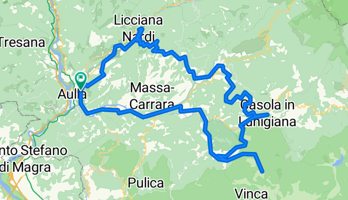
- Aulla, Tuscany, Italy
A cycling route starting in Aulla, Tuscany, Italy.
Overview
Percorso che segue in parte la Via del Volto Santo su asfalto. Dalla stazione di Aulla si raggiunge Licciana nardi e poi Fivizzano, Casola in Lunigiana e, infine EquiTerme. Si prova a percorrere il sentiero CAI 192 fino alle cave. Si torna indietro e ci si dirige a Gragnola, poi stazione di Fivizzano, Pallerone e di nuovo ad Aulla
created this 8 years ago
Route quality
Road
37.7 km
(48 %)
Quiet road
18.9 km
(24 %)
Paved
39.3 km
(50 %)
Unpaved
5.5 km
(7 %)
Asphalt
39.3 km
(50 %)
Ground
5.5 km
(7 %)
Undefined
33.8 km
(43 %)
Continue with Bikemap
You would like to ride Aulla-Fivizzano-Casola Lunigiana-Equi Terme-Aulla or customize it for your own trip? Here is what you can do with this Bikemap route:
Free trial for 3 days, or one-time payment. More about Bikemap Premium.
Discover more Premium features.
Get Bikemap PremiumFrom our community
Open it in the app


