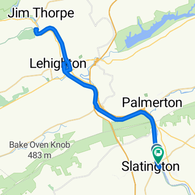
Slate Heritage Trail
A cycling route starting in Walnutport, Pennsylvania, United States.
Overview
About this route
A community-funded trail from Main Street trailhead in Slatington (shared with D&L tow-path trail) to a park just below Slatedale. A short trail with lots of farmland along the way.
Rumors on TrailLink of closure in middle of trail because of construction of new Turnpike bridge above trail. Comments are from 2015 - will check out in spring 2017 to see if closure is still there.
- -:--
- Duration
- 5.4 km
- Distance
- 80 m
- Ascent
- 41 m
- Descent
- ---
- Avg. speed
- ---
- Max. altitude
Route quality
Waytypes & surfaces along the route
Waytypes
Cycleway
5.3 km
(99 %)
Quiet road
0.1 km
(1 %)
Surfaces
Paved
0.8 km
(15 %)
Unpaved
1 km
(18 %)
Asphalt
0.8 km
(15 %)
Unpaved (undefined)
0.5 km
(10 %)
Continue with Bikemap
Use, edit, or download this cycling route
You would like to ride Slate Heritage Trail or customize it for your own trip? Here is what you can do with this Bikemap route:
Free features
- Save this route as favorite or in collections
- Copy & plan your own version of this route
- Sync your route with Garmin or Wahoo
Premium features
Free trial for 3 days, or one-time payment. More about Bikemap Premium.
- Navigate this route on iOS & Android
- Export a GPX / KML file of this route
- Create your custom printout (try it for free)
- Download this route for offline navigation
Discover more Premium features.
Get Bikemap PremiumFrom our community
Other popular routes starting in Walnutport
 D-L Trail, Slatington to D-L Trail, Slatington
- Distance
- 50 km
- Ascent
- 803 m
- Descent
- 805 m
- Location
- Walnutport, Pennsylvania, United States
 81–87 Main St, Slatington to 21–71 Main St, Slatington
- Distance
- 32.2 km
- Ascent
- 1,710 m
- Descent
- 1,697 m
- Location
- Walnutport, Pennsylvania, United States
 20 Main St, Slatington to 73–79 Main St, Slatington
- Distance
- 32.7 km
- Ascent
- 974 m
- Descent
- 967 m
- Location
- Walnutport, Pennsylvania, United States
 D & L Trail, Slatington to D & L Trail, Slatington
- Distance
- 19.4 km
- Ascent
- 300 m
- Descent
- 302 m
- Location
- Walnutport, Pennsylvania, United States
 Relaxed route in Slatington
- Distance
- 34.2 km
- Ascent
- 221 m
- Descent
- 228 m
- Location
- Walnutport, Pennsylvania, United States
 Slate Heritage Trail
- Distance
- 5.4 km
- Ascent
- 80 m
- Descent
- 41 m
- Location
- Walnutport, Pennsylvania, United States
 Slatington to Jim Thorpe, PA
- Distance
- 21.8 km
- Ascent
- 127 m
- Descent
- 78 m
- Location
- Walnutport, Pennsylvania, United States
 North Railroad Street 135, Slatington to West Bowmans Road 57, Lehighton
- Distance
- 9.9 km
- Ascent
- 26 m
- Descent
- 7 m
- Location
- Walnutport, Pennsylvania, United States
Open it in the app


