
Saucon Rail Trail
A cycling route starting in Hellertown, Pennsylvania, United States of America.
Overview
About this route
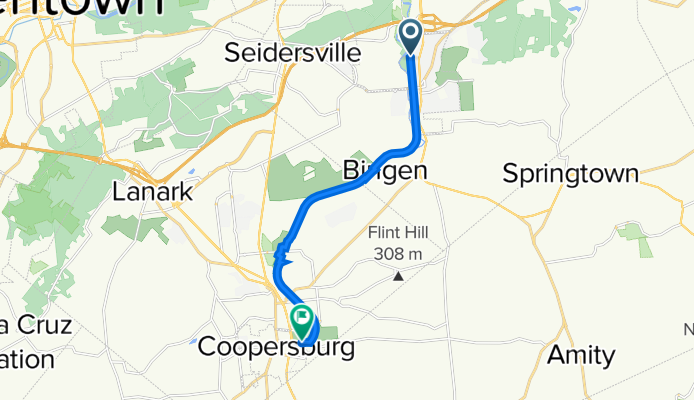
A trail following a former railbed from its northern terminus at Water Street Park in Hellertown (Bachman Street) to its southern terminus at Living Memorial Park (E Landis Street) in Coopersburg. There are several parking areas and road crossings along the way. The surface in Hellertown and Lower Saucon Township is loose ballast and a light-colored gravel. The surface in Upper Saucon Township is a more finely-crushed stone with a darker color.
Parking areas are available at:
Water Street Park, Hellertown (restrooms & water)
Grist Mill, Hellertown
Bingen Road & Reading Drive, Bethlehem (restrooms & water)
Upper Saucon Township Park, Preston Lane, Center Valley (restrooms & water)
Southern Lehigh Public Library, Preston Lane, Center Valley (restrooms & water)
Station Avenue, Center Valley
Living Memorial Park, Coopersburg (restrooms & water)
This trail is very wide, but is normally very active with walkers, runners, and bikers. It passes golf courses, large mansions, quite a few public parks, and DeSales University along the 11.4-kilometer journey.
- -:--
- Duration
- 11.4 km
- Distance
- 118 m
- Ascent
- 40 m
- Descent
- ---
- Avg. speed
- ---
- Max. altitude

Route quality
Waytypes & surfaces along the route
Waytypes
Cycleway
10.3 km
(90 %)
Pedestrian area
0.6 km
(5 %)
Surfaces
Paved
2 km
(18 %)
Unpaved
7.4 km
(65 %)
Gravel
4.4 km
(38 %)
Ground
2.8 km
(24 %)
Continue with Bikemap
Use, edit, or download this cycling route
You would like to ride Saucon Rail Trail or customize it for your own trip? Here is what you can do with this Bikemap route:
Free features
- Save this route as favorite or in collections
- Copy & plan your own version of this route
- Sync your route with Garmin or Wahoo
Premium features
Free trial for 3 days, or one-time payment. More about Bikemap Premium.
- Navigate this route on iOS & Android
- Export a GPX / KML file of this route
- Create your custom printout (try it for free)
- Download this route for offline navigation
Discover more Premium features.
Get Bikemap PremiumFrom our community
Other popular routes starting in Hellertown
 31–99 Penn St, Hellertown to 33 Penn St, Hellertown
- Distance
- 0.5 km
- Ascent
- 37 m
- Descent
- 39 m
- Location
- Hellertown, Pennsylvania, United States of America
 1887 Mansfield St, Hellertown to 1883 Mansfield St, Hellertown
- Distance
- 17.4 km
- Ascent
- 313 m
- Descent
- 314 m
- Location
- Hellertown, Pennsylvania, United States of America
 Snail-like route in Bethlehem
- Distance
- 8.2 km
- Ascent
- 133 m
- Descent
- 131 m
- Location
- Hellertown, Pennsylvania, United States of America
 122 E Saucon St, Hellertown to 120 E Saucon St, Hellertown
- Distance
- 11.8 km
- Ascent
- 147 m
- Descent
- 150 m
- Location
- Hellertown, Pennsylvania, United States of America
 537–565 W Water St, Hellertown to 1910 Pine Ct, Hellertown
- Distance
- 20.1 km
- Ascent
- 388 m
- Descent
- 365 m
- Location
- Hellertown, Pennsylvania, United States of America
 Relaxed route in Hellertown
- Distance
- 25.7 km
- Ascent
- 161 m
- Descent
- 161 m
- Location
- Hellertown, Pennsylvania, United States of America
 Hellertown Rail
- Distance
- 8 km
- Ascent
- 74 m
- Descent
- 75 m
- Location
- Hellertown, Pennsylvania, United States of America
 work 2
- Distance
- 51.3 km
- Ascent
- 416 m
- Descent
- 487 m
- Location
- Hellertown, Pennsylvania, United States of America
Open it in the app