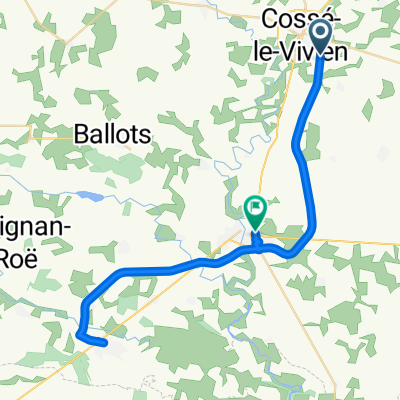
20170121_144500.gpx
A cycling route starting in Cossé-le-Vivien, Pays de la Loire Region, France.
Overview
About this route
TAHUNA track
- -:--
- Duration
- 22.2 km
- Distance
- 92 m
- Ascent
- 112 m
- Descent
- ---
- Avg. speed
- ---
- Avg. speed
Route quality
Waytypes & surfaces along the route
Waytypes
Path
7.3 km
(33 %)
Quiet road
6.7 km
(30 %)
Surfaces
Paved
0.8 km
(3 %)
Unpaved
5.2 km
(24 %)
Loose gravel
5.2 km
(24 %)
Asphalt
0.8 km
(3 %)
Undefined
16.2 km
(73 %)
Continue with Bikemap
Use, edit, or download this cycling route
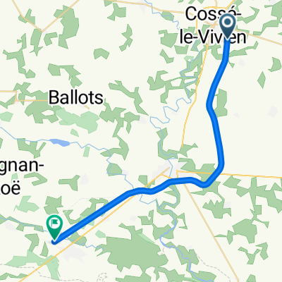
You would like to ride 20170121_144500.gpx or customize it for your own trip? Here is what you can do with this Bikemap route:
Free features
- Save this route as favorite or in collections
- Copy & plan your own version of this route
- Sync your route with Garmin or Wahoo
Premium features
Free trial for 3 days, or one-time payment. More about Bikemap Premium.
- Navigate this route on iOS & Android
- Export a GPX / KML file of this route
- Create your custom printout (try it for free)
- Download this route for offline navigation
Discover more Premium features.
Get Bikemap PremiumFrom our community
Other popular routes starting in Cossé-le-Vivien
- От La Crespière, Cossé-le-Vivien до Rue de Bretagne 23, Cossé-le-Vivien
- Distance
- 4.3 km
- Ascent
- 39 m
- Descent
- 41 m
- Location
- Cossé-le-Vivien, Pays de la Loire Region, France
- 20170128_143954.gpx
- Distance
- 52.3 km
- Ascent
- 343 m
- Descent
- 343 m
- Location
- Cossé-le-Vivien, Pays de la Loire Region, France
- Rue de Flandres-Dunkerque, Méral à 4 Rue Robert Tatin, Montjean
- Distance
- 6.7 km
- Ascent
- 68 m
- Descent
- 61 m
- Location
- Cossé-le-Vivien, Pays de la Loire Region, France
- 20170121_144500.gpx
- Distance
- 22.2 km
- Ascent
- 92 m
- Descent
- 112 m
- Location
- Cossé-le-Vivien, Pays de la Loire Region, France
- 20170211_144317.gpx
- Distance
- 42 km
- Ascent
- 205 m
- Descent
- 205 m
- Location
- Cossé-le-Vivien, Pays de la Loire Region, France
Open it in the app