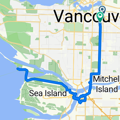
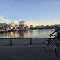
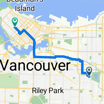
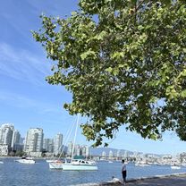
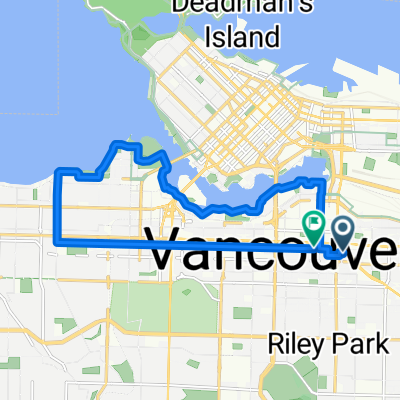
Canada
A cycling route starting in Vancouver, British Columbia, Canada.
Overview
About this route
- -:--
- Duration
- 2,962 km
- Distance
- 8,421 m
- Ascent
- 8,421 m
- Descent
- ---
- Avg. speed
- ---
- Avg. speed
Route highlights
Points of interest along the route
Point of interest after 38.6 km
Behind the rock camp, free
Point of interest after 64.1 km
Squamish climbers camp, free
Point of interest after 73.3 km
Brohm lake camp
Point of interest after 81.7 km
Chek canyon camp
Point of interest after 99.2 km
Cal - cheakcamp, 13 dollar
Point of interest after 101.1 km
Ironman Canada Bike 70 km
Point of interest after 130.6 km
Shadow lake interp forest, free
Point of interest after 242.6 km
Terzaghi (mission) dam camp, free
Point of interest after 288.8 km
Seton lake campground, free
Point of interest after 422.9 km
pressy lake free
Point of interest after 466.9 km
crystal lake free
Point of interest after 502.3 km
phinetta lake, free
Point of interest after 528.5 km
latremouiie lake free
Point of interest after 539.1 km
loko lake free
Point of interest after 655 km
lower messiter lake, free
Point of interest after 679.2 km
mud lake west , free
Point of interest after 744.3 km
upper canoe, free
Point of interest after 774.1 km
little lost lake, free
Point of interest after 1,041 km
Rampart creek, 16 dollars
Point of interest after 1,102.6 km
mosquito creek, 16 dollar
Point of interest after 1,631.6 km
radium wetlands
Point of interest after 1,713 km
johnson lake , free
Point of interest after 1,747 km
horseshoe lake free
Point of interest after 1,784.1 km
monroe lake camp, free
Point of interest after 1,850.3 km
goat river camp
Point of interest after 1,904.4 km
boundary lake campground, free
Point of interest after 2,049.6 km
little slocan, free
Point of interest after 2,270.1 km
mud lake , free
Point of interest after 2,383.3 km
jolly creek, free
Point of interest after 2,471.4 km
browne lake, free
Point of interest after 2,532.4 km
chute lake, free
Point of interest after 2,660.9 km
dewdney free
Point of interest after 2,744.6 km
little douglas lake free
Point of interest after 2,783.6 km
eaton cree, free
Point of interest after 2,817.3 km
riverside, tamihi creek + 4 more camps, 15 dollars
Continue with Bikemap
Use, edit, or download this cycling route
You would like to ride Canada or customize it for your own trip? Here is what you can do with this Bikemap route:
Free features
- Save this route as favorite or in collections
- Copy & plan your own version of this route
- Split it into stages to create a multi-day tour
- Sync your route with Garmin or Wahoo
Premium features
Free trial for 3 days, or one-time payment. More about Bikemap Premium.
- Navigate this route on iOS & Android
- Export a GPX / KML file of this route
- Create your custom printout (try it for free)
- Download this route for offline navigation
Discover more Premium features.
Get Bikemap PremiumFrom our community
Other popular routes starting in Vancouver
- Short bike tour from May 11, 14:45
- Distance
- 7.4 km
- Ascent
- 50 m
- Descent
- 53 m
- Location
- Vancouver, British Columbia, Canada
- 40k UBC cw
- Distance
- 39.4 km
- Ascent
- 402 m
- Descent
- 405 m
- Location
- Vancouver, British Columbia, Canada
- UBC-Queen Elizabeth Park
- Distance
- 38.2 km
- Ascent
- 305 m
- Descent
- 306 m
- Location
- Vancouver, British Columbia, Canada
- VancouverUBC, Kits Beach ride
- Distance
- 28.8 km
- Ascent
- 223 m
- Descent
- 223 m
- Location
- Vancouver, British Columbia, Canada
- 100 K Loop
- Distance
- 108.1 km
- Ascent
- 333 m
- Descent
- 335 m
- Location
- Vancouver, British Columbia, Canada
- 34k UBC cw
- Distance
- 34.1 km
- Ascent
- 357 m
- Descent
- 360 m
- Location
- Vancouver, British Columbia, Canada
- Route to Jericho beach
- Distance
- 11.9 km
- Ascent
- 64 m
- Descent
- 139 m
- Location
- Vancouver, British Columbia, Canada
- Crown-UBC-4th Ave Hill circuit
- Distance
- 24.8 km
- Ascent
- 235 m
- Descent
- 236 m
- Location
- Vancouver, British Columbia, Canada
Open it in the app