

Rdstrk. Gächingen, Marbach, Wasserstetten
A cycling route starting in Gomadingen, Baden-Wurttemberg, Germany.
Overview
About this route
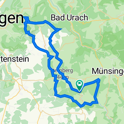
Circuit route with a visit to Landesgestüt Marbach, Grafeneck memorial, Lautertal 45 km, 430 m elevation gain.
- -:--
- Duration
- 45.6 km
- Distance
- 381 m
- Ascent
- 381 m
- Descent
- ---
- Avg. speed
- ---
- Max. altitude

Route quality
Waytypes & surfaces along the route
Waytypes
Track
34.2 km
(75 %)
Quiet road
5.5 km
(12 %)
Surfaces
Paved
30.1 km
(66 %)
Unpaved
14.6 km
(32 %)
Asphalt
26.9 km
(59 %)
Gravel
5.9 km
(13 %)
Continue with Bikemap
Use, edit, or download this cycling route
You would like to ride Rdstrk. Gächingen, Marbach, Wasserstetten or customize it for your own trip? Here is what you can do with this Bikemap route:
Free features
- Save this route as favorite or in collections
- Copy & plan your own version of this route
- Sync your route with Garmin or Wahoo
Premium features
Free trial for 3 days, or one-time payment. More about Bikemap Premium.
- Navigate this route on iOS & Android
- Export a GPX / KML file of this route
- Create your custom printout (try it for free)
- Download this route for offline navigation
Discover more Premium features.
Get Bikemap PremiumFrom our community
Other popular routes starting in Gomadingen
 Lautertal-Route 2
- Distance
- 51.2 km
- Ascent
- 783 m
- Descent
- 784 m
- Location
- Gomadingen, Baden-Wurttemberg, Germany
 Leutkirch Trip
- Distance
- 109.9 km
- Ascent
- 1,267 m
- Descent
- 1,287 m
- Location
- Gomadingen, Baden-Wurttemberg, Germany
 Marbacher Gestütsradweg
- Distance
- 57.5 km
- Ascent
- 789 m
- Descent
- 794 m
- Location
- Gomadingen, Baden-Wurttemberg, Germany
 Tour 3 – Käsegeschichten
- Distance
- 34.1 km
- Ascent
- 294 m
- Descent
- 297 m
- Location
- Gomadingen, Baden-Wurttemberg, Germany
 Rdstrk. Gächingen, Marbach, Wasserstetten
- Distance
- 45.6 km
- Ascent
- 381 m
- Descent
- 381 m
- Location
- Gomadingen, Baden-Wurttemberg, Germany
 Route in Hohenstein
- Distance
- 67.1 km
- Ascent
- 1,441 m
- Descent
- 1,438 m
- Location
- Gomadingen, Baden-Wurttemberg, Germany
 Von Hohenstein bis Lauterach
- Distance
- 33.4 km
- Ascent
- 917 m
- Descent
- 1,104 m
- Location
- Gomadingen, Baden-Wurttemberg, Germany
 Lautertal
- Distance
- 60.9 km
- Ascent
- 1,557 m
- Descent
- 1,556 m
- Location
- Gomadingen, Baden-Wurttemberg, Germany
Open it in the app