Nach Recklinghausen-Suderwich_57km
A cycling route starting in Waltrop, North Rhine-Westphalia, Germany.
Overview
About this route
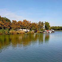
Tour Characteristics Route Length: 57 km Average Speed: 15-18 km/h Surface: Asphalt field and forest paths Difficulty Level: Easy Incline: Flat Tour Type: Half Day Trip Day Trip Environment: Industrial Culture city meadows & fields Traffic Load: Low Motor Traffic Target Group: Cultural Tour Description Outbound through Grävingholz, Deusen, Nette, Bodelschwingh, Rauxel and Pöppinghausen. Passes by Bodelschwingh Castle, the Hammerkopf Tower of the former Erin Mine (around the Celtic tree circle) and Bladenhorst Castle. Refreshment options in the historic town center of Suderwich. Return route via Becklem, Ickern and Mengede. Start and end: Lüntec, Brambauer.
- -:--
- Duration
- 56.1 km
- Distance
- 178 m
- Ascent
- 178 m
- Descent
- ---
- Avg. speed
- ---
- Max. altitude
Continue with Bikemap
Use, edit, or download this cycling route
You would like to ride Nach Recklinghausen-Suderwich_57km or customize it for your own trip? Here is what you can do with this Bikemap route:
Free features
- Save this route as favorite or in collections
- Copy & plan your own version of this route
- Sync your route with Garmin or Wahoo
Premium features
Free trial for 3 days, or one-time payment. More about Bikemap Premium.
- Navigate this route on iOS & Android
- Export a GPX / KML file of this route
- Create your custom printout (try it for free)
- Download this route for offline navigation
Discover more Premium features.
Get Bikemap PremiumFrom our community
Other popular routes starting in Waltrop
- Sonntag
- Distance
- 42.2 km
- Ascent
- 95 m
- Descent
- 93 m
- Location
- Waltrop, North Rhine-Westphalia, Germany
- König Ludwig Trasse Bis Halde
- Distance
- 27.8 km
- Ascent
- 175 m
- Descent
- 105 m
- Location
- Waltrop, North Rhine-Westphalia, Germany
- Castrop-Rauxel
- Distance
- 53.9 km
- Ascent
- 716 m
- Descent
- 722 m
- Location
- Waltrop, North Rhine-Westphalia, Germany
- RTF Sprinter Waltrop
- Distance
- 110.2 km
- Ascent
- 310 m
- Descent
- 317 m
- Location
- Waltrop, North Rhine-Westphalia, Germany
- Schleuse Henrichenburg n. Haltern aS 60 km
- Distance
- 59 km
- Ascent
- 126 m
- Descent
- 123 m
- Location
- Waltrop, North Rhine-Westphalia, Germany
- Lüner Münsterlandrunde
- Distance
- 81.8 km
- Ascent
- 163 m
- Descent
- 163 m
- Location
- Waltrop, North Rhine-Westphalia, Germany
- WA-LÜ-BOR-WA
- Distance
- 35.8 km
- Ascent
- 139 m
- Descent
- 139 m
- Location
- Waltrop, North Rhine-Westphalia, Germany
- Frühjahrs-RTF Waltrop
- Distance
- 102.8 km
- Ascent
- 303 m
- Descent
- 313 m
- Location
- Waltrop, North Rhine-Westphalia, Germany
Open it in the app