

Polhograjci čez Topol
A cycling route starting in Zgornje Pirniče, Medvode, Slovenia.
Overview
About this route
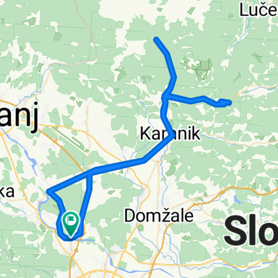
Šentvid - Toško čelo - Topol - Slavkov dom - Seničica - Medno - Šentvid
- -:--
- Duration
- 24.2 km
- Distance
- 374 m
- Ascent
- 373 m
- Descent
- ---
- Avg. speed
- ---
- Max. altitude

Route quality
Waytypes & surfaces along the route
Waytypes
Quiet road
14.3 km
(59 %)
Road
5.5 km
(23 %)
Surfaces
Paved
14.5 km
(60 %)
Unpaved
7.6 km
(31 %)
Asphalt
14.5 km
(60 %)
Gravel
5 km
(21 %)
Continue with Bikemap
Use, edit, or download this cycling route
You would like to ride Polhograjci čez Topol or customize it for your own trip? Here is what you can do with this Bikemap route:
Free features
- Save this route as favorite or in collections
- Copy & plan your own version of this route
- Sync your route with Garmin or Wahoo
Premium features
Free trial for 3 days, or one-time payment. More about Bikemap Premium.
- Navigate this route on iOS & Android
- Export a GPX / KML file of this route
- Create your custom printout (try it for free)
- Download this route for offline navigation
Discover more Premium features.
Get Bikemap PremiumFrom our community
Other popular routes starting in Zgornje Pirniče
 šmartno Rašica
- Distance
- 5.2 km
- Ascent
- 437 m
- Descent
- 136 m
- Location
- Zgornje Pirniče, Medvode, Slovenia
 medvode
- Distance
- 29.5 km
- Ascent
- 781 m
- Descent
- 812 m
- Location
- Zgornje Pirniče, Medvode, Slovenia
 Mihova pot 4
- Distance
- 54.5 km
- Ascent
- 175 m
- Descent
- 175 m
- Location
- Zgornje Pirniče, Medvode, Slovenia
 Polhograjci čez Topol
- Distance
- 24.2 km
- Ascent
- 374 m
- Descent
- 373 m
- Location
- Zgornje Pirniče, Medvode, Slovenia
 Kamnška Bistrica + Črnivec + ogled del trase dirke po sloveniji
- Distance
- 91.5 km
- Ascent
- 818 m
- Descent
- 818 m
- Location
- Zgornje Pirniče, Medvode, Slovenia
 Route to Zbilje 67A, 1215 Medvode
- Distance
- 43.7 km
- Ascent
- 998 m
- Descent
- 1,004 m
- Location
- Zgornje Pirniče, Medvode, Slovenia
 Iz Dragočajne Pod storžič
- Distance
- 46.5 km
- Ascent
- 273 m
- Descent
- 273 m
- Location
- Zgornje Pirniče, Medvode, Slovenia
 Pot dveh Savskih jezer
- Distance
- 33.4 km
- Ascent
- 290 m
- Descent
- 290 m
- Location
- Zgornje Pirniče, Medvode, Slovenia
Open it in the app