

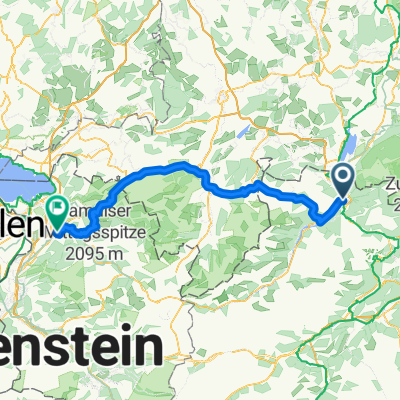
Reutte - Dornbirn (Romberg) über Deutschland
A cycling route starting in Reutte, Tyrol, Austria.
Overview
About this route
Reutte-Weißenbach /Lech-Hacklensee-Bad Hindelang-Immenstadt-Thalkirchdorf-Krumbach-Alberschwende-Schwarzach-Dornbirn (Romberg) 110 km; 1100 m elevation gain
- -:--
- Duration
- 115.4 km
- Distance
- 1,196 m
- Ascent
- 1,504 m
- Descent
- ---
- Avg. speed
- ---
- Max. altitude

Route quality
Waytypes & surfaces along the route
Waytypes
Quiet road
19.6 km
(17 %)
Road
9.2 km
(8 %)
Surfaces
Paved
97 km
(84 %)
Unpaved
9.2 km
(8 %)
Asphalt
95.8 km
(83 %)
Gravel
3.5 km
(3 %)
Continue with Bikemap
Use, edit, or download this cycling route
You would like to ride Reutte - Dornbirn (Romberg) über Deutschland or customize it for your own trip? Here is what you can do with this Bikemap route:
Free features
- Save this route as favorite or in collections
- Copy & plan your own version of this route
- Split it into stages to create a multi-day tour
- Sync your route with Garmin or Wahoo
Premium features
Free trial for 3 days, or one-time payment. More about Bikemap Premium.
- Navigate this route on iOS & Android
- Export a GPX / KML file of this route
- Create your custom printout (try it for free)
- Download this route for offline navigation
Discover more Premium features.
Get Bikemap PremiumFrom our community
Other popular routes starting in Reutte
 Alpenrunde Teil 7
- Distance
- 72.8 km
- Ascent
- 1,839 m
- Descent
- 1,906 m
- Location
- Reutte, Tyrol, Austria
 Lechtal - Achensee
- Distance
- 268.7 km
- Ascent
- 2,103 m
- Descent
- 2,106 m
- Location
- Reutte, Tyrol, Austria
 Via Claudia Augusta 4
- Distance
- 63.3 km
- Ascent
- 640 m
- Descent
- 789 m
- Location
- Reutte, Tyrol, Austria
 Reutte - Dornbirn (Romberg) über Deutschland
- Distance
- 115.4 km
- Ascent
- 1,196 m
- Descent
- 1,504 m
- Location
- Reutte, Tyrol, Austria
 2014_Bolsena-Kempten_04
- Distance
- 19.7 km
- Ascent
- 109 m
- Descent
- 150 m
- Location
- Reutte, Tyrol, Austria
 Reutte Plansee
- Distance
- 12.3 km
- Ascent
- 279 m
- Descent
- 1,132 m
- Location
- Reutte, Tyrol, Austria
 Reute - Navene
- Distance
- 342.4 km
- Ascent
- 1,449 m
- Descent
- 2,180 m
- Location
- Reutte, Tyrol, Austria
 lechtal Tour
- Distance
- 116.6 km
- Ascent
- 983 m
- Descent
- 725 m
- Location
- Reutte, Tyrol, Austria
Open it in the app