

2017-21 février andancette
A cycling route starting in Andancette, Auvergne-Rhône-Alpes, France.
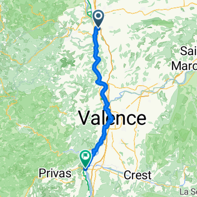
Overview
About this route
- 2 h 19 min
- Duration
- 20.9 km
- Distance
- 26 m
- Ascent
- 29 m
- Descent
- 9 km/h
- Avg. speed
- ---
- Max. altitude

Route quality
Waytypes & surfaces along the route
Waytypes
Cycleway
15 km
(72 %)
Quiet road
4 km
(19 %)
Surfaces
Paved
16.3 km
(78 %)
Asphalt
16.3 km
(78 %)
Undefined
4.6 km
(22 %)
Continue with Bikemap
Use, edit, or download this cycling route
You would like to ride 2017-21 février andancette or customize it for your own trip? Here is what you can do with this Bikemap route:
Free features
- Save this route as favorite or in collections
- Copy & plan your own version of this route
- Sync your route with Garmin or Wahoo
Premium features
Free trial for 3 days, or one-time payment. More about Bikemap Premium.
- Navigate this route on iOS & Android
- Export a GPX / KML file of this route
- Create your custom printout (try it for free)
- Download this route for offline navigation
Discover more Premium features.
Get Bikemap PremiumFrom our community
Other popular routes starting in Andancette
 Col de la charousse
- Distance
- 39.2 km
- Ascent
- 1,251 m
- Descent
- 135 m
- Location
- Andancette, Auvergne-Rhône-Alpes, France
 Saint Rambert d'Albon - Le Pouzin
- Distance
- 78.8 km
- Ascent
- 215 m
- Descent
- 284 m
- Location
- Andancette, Auvergne-Rhône-Alpes, France
 J4D RC2 MIPIM 2018
- Distance
- 41.9 km
- Ascent
- 101 m
- Descent
- 124 m
- Location
- Andancette, Auvergne-Rhône-Alpes, France
 France2023 E9
- Distance
- 78.7 km
- Ascent
- 280 m
- Descent
- 290 m
- Location
- Andancette, Auvergne-Rhône-Alpes, France
 Etape 7
- Distance
- 29.9 km
- Ascent
- 52 m
- Descent
- 83 m
- Location
- Andancette, Auvergne-Rhône-Alpes, France
 Andancette Sablons et plus loin
- Distance
- 37.4 km
- Ascent
- 32 m
- Descent
- 34 m
- Location
- Andancette, Auvergne-Rhône-Alpes, France
 Grand bois
- Distance
- 37 km
- Ascent
- 1,086 m
- Descent
- 76 m
- Location
- Andancette, Auvergne-Rhône-Alpes, France
 4 Route nach Viviers
- Distance
- 120 km
- Ascent
- 464 m
- Descent
- 499 m
- Location
- Andancette, Auvergne-Rhône-Alpes, France
Open it in the app