
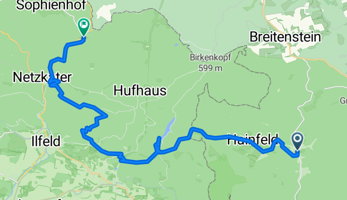
W_Harz03_Stolberg_Ilfeld
A cycling route starting in Stolberg, Saxony-Anhalt, Germany.
Overview
About this route
Noch nicht gewandert
- -:--
- Duration
- 25.2 km
- Distance
- 770 m
- Ascent
- 717 m
- Descent
- ---
- Avg. speed
- ---
- Max. altitude

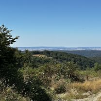
Route highlights
Points of interest along the route
Point of interest after 8.2 km
Ältester Stausee
Point of interest after 12.1 km
Coole Burgruine
Point of interest after 17.4 km
Aussichtsturm
Point of interest after 22.2 km
Bergwerk?
Continue with Bikemap
Use, edit, or download this cycling route
You would like to ride W_Harz03_Stolberg_Ilfeld or customize it for your own trip? Here is what you can do with this Bikemap route:
Free features
- Save this route as favorite or in collections
- Copy & plan your own version of this route
- Sync your route with Garmin or Wahoo
Premium features
Free trial for 3 days, or one-time payment. More about Bikemap Premium.
- Navigate this route on iOS & Android
- Export a GPX / KML file of this route
- Create your custom printout (try it for free)
- Download this route for offline navigation
Discover more Premium features.
Get Bikemap PremiumFrom our community
Other popular routes starting in Stolberg
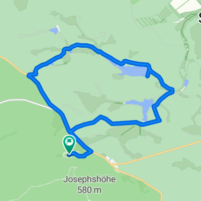
 MMIRunde2014
- Distance
- 51.6 km
- Ascent
- 558 m
- Descent
- 558 m
- Location
- Stolberg, Saxony-Anhalt, Germany
 Final_Stolberg_Wernigerode_Harzburg
- Distance
- 93.2 km
- Ascent
- 796 m
- Descent
- 1,013 m
- Location
- Stolberg, Saxony-Anhalt, Germany
 2.Etappe Stolberg_Stolberg
- Distance
- 116.8 km
- Ascent
- 1,019 m
- Descent
- 1,019 m
- Location
- Stolberg, Saxony-Anhalt, Germany
 Schindelbr. Talsperre Kiliansteich Runde
- Distance
- 11 km
- Ascent
- 174 m
- Descent
- 174 m
- Location
- Stolberg, Saxony-Anhalt, Germany
 W_Harz03_Stolberg_Ilfeld
- Distance
- 25.2 km
- Ascent
- 770 m
- Descent
- 717 m
- Location
- Stolberg, Saxony-Anhalt, Germany
 Final_Stolberg_Wernigerode_Harzburg
- Distance
- 94.7 km
- Ascent
- 767 m
- Descent
- 985 m
- Location
- Stolberg, Saxony-Anhalt, Germany
 Auf der Höhe, Südharz nach Auf der Höhe, Südharz
- Distance
- 13.4 km
- Ascent
- 196 m
- Descent
- 195 m
- Location
- Stolberg, Saxony-Anhalt, Germany
 Schindelbr. Schweda Runde
- Distance
- 17.9 km
- Ascent
- 400 m
- Descent
- 400 m
- Location
- Stolberg, Saxony-Anhalt, Germany
Open it in the app