Łęczycka 26 - Owiany złą sławą Hotelowiec do Łokietka 89
- 8.2 km
- 87 m
- 103 m
- Gronowo Górne, Warmian-Masurian Voivodeship, Poland
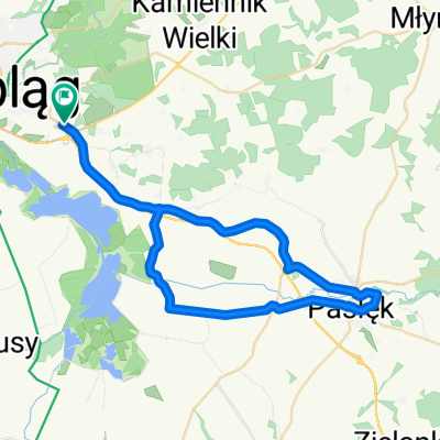
A cycling route starting in Gronowo Górne, Warmian-Masurian Voivodeship, Poland.
Overview
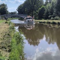
Elbląg Canal in winter
created this 8 years ago

Route quality
Access road
16.1 km
(36 %)
Quiet road
15.7 km
(35 %)
Paved
9.9 km
(22 %)
Unpaved
4 km
(9 %)
Asphalt
7.6 km
(17 %)
Ground
3.6 km
(8 %)
Continue with Bikemap
You would like to ride MWR 2017 - ZAMROŻONY KANAŁ ELBLĄSKI or customize it for your own trip? Here is what you can do with this Bikemap route:
Free trial for 3 days, or one-time payment. More about Bikemap Premium.
Discover more Premium features.
Get Bikemap PremiumFrom our community
Open it in the app