

Long bike tour from 26/02/17 12:55
A cycling route starting in San Marcos Yachihuacaltepec, State of Mexico, Mexico.
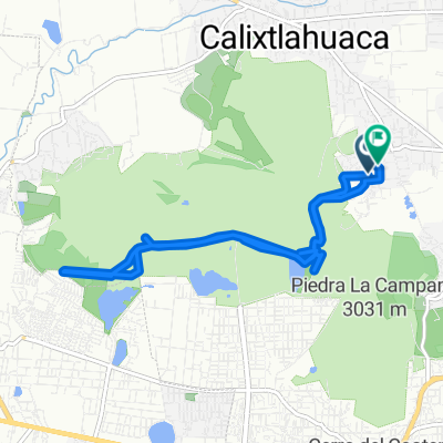
Overview
About this route
- -:--
- Duration
- 126.5 km
- Distance
- 778 m
- Ascent
- 851 m
- Descent
- ---
- Avg. speed
- ---
- Max. altitude
Continue with Bikemap
Use, edit, or download this cycling route
You would like to ride Long bike tour from 26/02/17 12:55 or customize it for your own trip? Here is what you can do with this Bikemap route:
Free features
- Save this route as favorite or in collections
- Copy & plan your own version of this route
- Split it into stages to create a multi-day tour
- Sync your route with Garmin or Wahoo
Premium features
Free trial for 3 days, or one-time payment. More about Bikemap Premium.
- Navigate this route on iOS & Android
- Export a GPX / KML file of this route
- Create your custom printout (try it for free)
- Download this route for offline navigation
Discover more Premium features.
Get Bikemap PremiumFrom our community
Other popular routes starting in San Marcos Yachihuacaltepec
 calentando
- Distance
- 27.9 km
- Ascent
- 958 m
- Descent
- 987 m
- Location
- San Marcos Yachihuacaltepec, State of Mexico, Mexico
 calentamiento
- Distance
- 21 km
- Ascent
- 296 m
- Descent
- 310 m
- Location
- San Marcos Yachihuacaltepec, State of Mexico, Mexico
 Avenida Río Papaloapan 208, Toluca de Lerdo a Calle 21 de Marzo 113, Toluca de Lerdo
- Distance
- 12.4 km
- Ascent
- 399 m
- Descent
- 399 m
- Location
- San Marcos Yachihuacaltepec, State of Mexico, Mexico
 De Agustín Melgar 18, San Mateo Oxtotitlán a Filiberto Navas 111, San Mateo Oxtotitlán
- Distance
- 21.9 km
- Ascent
- 509 m
- Descent
- 513 m
- Location
- San Marcos Yachihuacaltepec, State of Mexico, Mexico
 De Mariano Matamoros a Mariano Matamoros
- Distance
- 12.1 km
- Ascent
- 318 m
- Descent
- 308 m
- Location
- San Marcos Yachihuacaltepec, State of Mexico, Mexico
 calentamientos
- Distance
- 18.8 km
- Ascent
- 436 m
- Descent
- 447 m
- Location
- San Marcos Yachihuacaltepec, State of Mexico, Mexico
 prueba 2
- Distance
- 3.1 km
- Ascent
- 90 m
- Descent
- 88 m
- Location
- San Marcos Yachihuacaltepec, State of Mexico, Mexico
 Paseo lento
- Distance
- 4.3 km
- Ascent
- 149 m
- Descent
- 202 m
- Location
- San Marcos Yachihuacaltepec, State of Mexico, Mexico
Open it in the app