

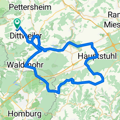
Altenglan Lauterecken Hirschhorn
A cycling route starting in Altenkirchen, Rhineland-Palatinate, Germany.
Overview
About this route
Jetzt weiss ich was es heisst dauerhaft schnell zu fahren. Auf den letzten 30 km extremer Gegenwind. Trotzdem mit Stolz "Zweiter" geworden.
- -:--
- Duration
- 109.1 km
- Distance
- 426 m
- Ascent
- 426 m
- Descent
- ---
- Avg. speed
- ---
- Max. altitude
Route quality
Waytypes & surfaces along the route
Waytypes
Busy road
71.1 km
(65 %)
Path
18.7 km
(17 %)
Surfaces
Paved
102.2 km
(94 %)
Unpaved
0.6 km
(<1 %)
Asphalt
99.7 km
(91 %)
Paved (undefined)
1.3 km
(1 %)
Continue with Bikemap
Use, edit, or download this cycling route
You would like to ride Altenglan Lauterecken Hirschhorn or customize it for your own trip? Here is what you can do with this Bikemap route:
Free features
- Save this route as favorite or in collections
- Copy & plan your own version of this route
- Split it into stages to create a multi-day tour
- Sync your route with Garmin or Wahoo
Premium features
Free trial for 3 days, or one-time payment. More about Bikemap Premium.
- Navigate this route on iOS & Android
- Export a GPX / KML file of this route
- Create your custom printout (try it for free)
- Download this route for offline navigation
Discover more Premium features.
Get Bikemap PremiumFrom our community
Other popular routes starting in Altenkirchen
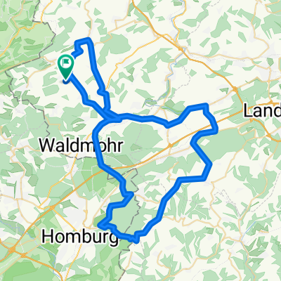
 Brücken Hauptstuhl Martinshöhe Lambsborn Waldmohr
- Distance
- 56.2 km
- Ascent
- 466 m
- Descent
- 466 m
- Location
- Altenkirchen, Rhineland-Palatinate, Germany
 Krottelbach Kusel Lauterecken Meisenheim Osterbrücken Werschweiler
- Distance
- 123.9 km
- Ascent
- 623 m
- Descent
- 615 m
- Location
- Altenkirchen, Rhineland-Palatinate, Germany
 Waldmohr Vogelbach Hauptstuhl Nanzdietschweiler Schülerfahrt
- Distance
- 46.1 km
- Ascent
- 168 m
- Descent
- 168 m
- Location
- Altenkirchen, Rhineland-Palatinate, Germany
 Hütschenhausen>Hauptstuhl>Martinshöhe>Homburg
- Distance
- 64.6 km
- Ascent
- 569 m
- Descent
- 569 m
- Location
- Altenkirchen, Rhineland-Palatinate, Germany
 Altenglan-Kusel-Werschweiler-Frohnhofen
- Distance
- 65.8 km
- Ascent
- 462 m
- Descent
- 462 m
- Location
- Altenkirchen, Rhineland-Palatinate, Germany
 Kusel>Altenglan> Ramstein-Miesenbach>Hütschenhausen und Heim CLONED FROM ROUTE 1766172
- Distance
- 64.7 km
- Ascent
- 337 m
- Descent
- 337 m
- Location
- Altenkirchen, Rhineland-Palatinate, Germany
 Bechhofen Homburg Bexbach Münchwies Führt Werschweiler
- Distance
- 53.3 km
- Ascent
- 486 m
- Descent
- 471 m
- Location
- Altenkirchen, Rhineland-Palatinate, Germany
 Elschbach Altenglan Lauterecken Hirschhorn
- Distance
- 108.3 km
- Ascent
- 445 m
- Descent
- 445 m
- Location
- Altenkirchen, Rhineland-Palatinate, Germany
Open it in the app