

2017 - Přejezd slovenských hor
A cycling route starting in Jablunkov, Moravskoslezský kraj, Czechia.
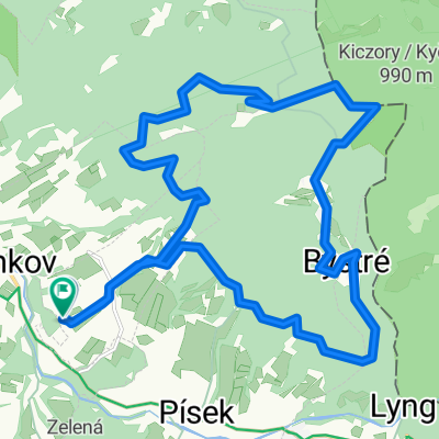
Overview
About this route
-
-
-
-
- 2017
-
-
-
Due to bad weather conditions and constant flight from the rain, the event was moved up one day.
Návsí - Čadca - Oravská Lesná - Dolný Kubín - Ružomberok - Turčianske Teplice - Púchov - Horní Lidč
- -:--
- Duration
- 352.9 km
- Distance
- 2,692 m
- Ascent
- 2,610 m
- Descent
- ---
- Avg. speed
- ---
- Max. altitude

Route quality
Waytypes & surfaces along the route
Waytypes
Road
120 km
(34 %)
Quiet road
45.9 km
(13 %)
Surfaces
Paved
211.7 km
(60 %)
Unpaved
17.6 km
(5 %)
Asphalt
211.7 km
(60 %)
Gravel
14.1 km
(4 %)
Route highlights
Points of interest along the route
Drinking water after 10.2 km
Kofola
Accommodation after 31.7 km
1. nocleh
Drinking water after 32.9 km
Snídaně
Drinking water after 32.9 km
večeře + pivo
Drinking water after 34 km
kofola + borovička
Drinking water after 51.5 km
pivo + káva
Drinking water after 78.2 km
oběd
Drinking water after 95.8 km
pivo
Drinking water after 116.2 km
večeře + pivo
Accommodation after 122.9 km
2. nocleh
Drinking water after 123.2 km
pivo
Drinking water after 123.2 km
snídaně
Drinking water after 133.9 km
pivo + káva
Point of interest after 136.4 km
termální pramen Kalameny
Drinking water after 155.9 km
Vlčí dvor oběd
Drinking water after 168.6 km
pivo
Drinking water after 173.3 km
pivo
Drinking water after 195.3 km
večeře + pivo
Drinking water after 195.5 km
pivo
Accommodation after 195.5 km
3. nocleh úkryt před hodně velkou bouřkou
Drinking water after 199.8 km
pivo + úkryt před deštěm
Drinking water after 221.7 km
oběd v Motorestu
Bike service after 241.1 km
chlupáč - výměna špalíků
Drinking water after 241.1 km
Znievsky dvor pivo
Drinking water after 257.8 km
pivo
Drinking water after 265.8 km
kofola
Accommodation after 277.3 km
4. nocleh
Drinking water after 277.6 km
pivo + večeře (křupky + bramburky + arašídy)
Drinking water after 286.7 km
kofola + káva
Drinking water after 315.2 km
pivo
Drinking water after 325.3 km
oběd + pivo
Point of interest after 325.3 km
Broňa jel na vlak, zbytek do Horní Lidče
Drinking water after 336.4 km
pivo
Point of interest after 336.4 km
mávačka na vlak
Point of interest after 341.1 km
pekáreň
Point of interest after 343.5 km
kontrola krčmy - zavřeno
Drinking water after 348.2 km
pivo + káva
Drinking water after 352.9 km
pivo
Continue with Bikemap
Use, edit, or download this cycling route
You would like to ride 2017 - Přejezd slovenských hor or customize it for your own trip? Here is what you can do with this Bikemap route:
Free features
- Save this route as favorite or in collections
- Copy & plan your own version of this route
- Split it into stages to create a multi-day tour
- Sync your route with Garmin or Wahoo
Premium features
Free trial for 3 days, or one-time payment. More about Bikemap Premium.
- Navigate this route on iOS & Android
- Export a GPX / KML file of this route
- Create your custom printout (try it for free)
- Download this route for offline navigation
Discover more Premium features.
Get Bikemap PremiumFrom our community
Other popular routes starting in Jablunkov
 MTB - Písek - Bahenec - Kiczora - Jaworzynka - Hrčava - Trojmezí - Bukovec - Písek
- Distance
- 34.7 km
- Ascent
- 946 m
- Descent
- 946 m
- Location
- Jablunkov, Moravskoslezský kraj, Czechia
 Szańce Jabłonkowskie
- Distance
- 58.5 km
- Ascent
- 1,063 m
- Descent
- 1,064 m
- Location
- Jablunkov, Moravskoslezský kraj, Czechia
 Minćol 1394
- Distance
- 165.1 km
- Ascent
- 1,986 m
- Descent
- 1,986 m
- Location
- Jablunkov, Moravskoslezský kraj, Czechia
 Podjazd na Bahenec
- Distance
- 6.5 km
- Ascent
- 388 m
- Descent
- 29 m
- Location
- Jablunkov, Moravskoslezský kraj, Czechia
 Zimowa Jaworzynka, Hrćava & Studenićny
- Distance
- 41.9 km
- Ascent
- 594 m
- Descent
- 596 m
- Location
- Jablunkov, Moravskoslezský kraj, Czechia
 2017 - Přejezd slovenských hor
- Distance
- 352.9 km
- Ascent
- 2,692 m
- Descent
- 2,610 m
- Location
- Jablunkov, Moravskoslezský kraj, Czechia
 Velky Polom 25.10.14
- Distance
- 40 km
- Ascent
- 815 m
- Descent
- 815 m
- Location
- Jablunkov, Moravskoslezský kraj, Czechia
 podvečer okolo Bahence
- Distance
- 19.6 km
- Ascent
- 614 m
- Descent
- 618 m
- Location
- Jablunkov, Moravskoslezský kraj, Czechia
Open it in the app