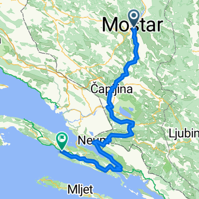
Ćirina Pruga 1.dio: Mostar - Čapljina
A cycling route starting in Mostar, Federation of Bosnia and Herzegovina, Bosnia and Herzegovina.
Overview
About this route
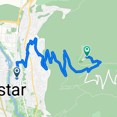
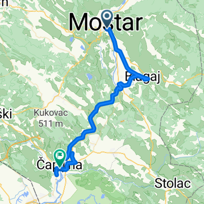
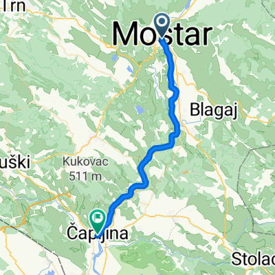
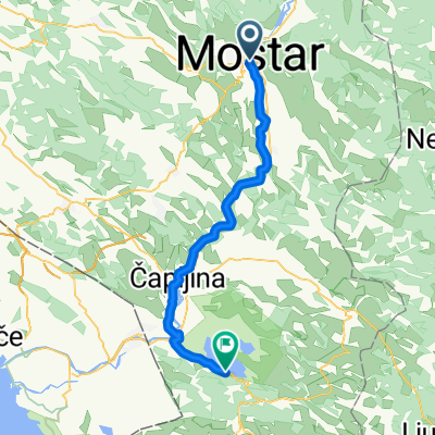
1. 09:00-10:00 City of Mostar 2. 10:00-11:00 Cycling route Mostar-Blagaj 3. 13:00-15:00 Cycling route Blagaj-Čapljina-Počitelj 4. 15:00-16:00 Sightseeing the Old city of Počitelj 5. 16:00-16:30 Cycling route Počitelj-Mogorjelo 6. 16:30-17:15 Sightseeing of monument Mogorjelo 7. 17:45-18:00 Checking in to a hotel in Čapljina town
- -:--
- Duration
- 64.6 km
- Distance
- 258 m
- Ascent
- 312 m
- Descent
- ---
- Avg. speed
- ---
- Avg. speed
Route quality
Waytypes & surfaces along the route
Waytypes
Quiet road
24.8 km
(38 %)
Road
21.1 km
(33 %)
Surfaces
Paved
48.2 km
(75 %)
Unpaved
0.1 km
(<1 %)
Asphalt
47.7 km
(74 %)
Paving stones
0.5 km
(<1 %)
Continue with Bikemap
Use, edit, or download this cycling route
You would like to ride Ćirina Pruga 1.dio: Mostar - Čapljina or customize it for your own trip? Here is what you can do with this Bikemap route:
Free features
- Save this route as favorite or in collections
- Copy & plan your own version of this route
- Sync your route with Garmin or Wahoo
Premium features
Free trial for 3 days, or one-time payment. More about Bikemap Premium.
- Navigate this route on iOS & Android
- Export a GPX / KML file of this route
- Create your custom printout (try it for free)
- Download this route for offline navigation
Discover more Premium features.
Get Bikemap PremiumFrom our community
Other popular routes starting in Mostar
- 11 - ECT 2013 - MOSTAR - DUBROVNIK (140km)
- Distance
- 138.1 km
- Ascent
- 713 m
- Descent
- 777 m
- Location
- Mostar, Federation of Bosnia and Herzegovina, Bosnia and Herzegovina
- Mostar - Blace
- Distance
- 71.9 km
- Ascent
- 649 m
- Descent
- 713 m
- Location
- Mostar, Federation of Bosnia and Herzegovina, Bosnia and Herzegovina
- Mostar-Kameni vinogradi
- Distance
- 86.5 km
- Ascent
- 923 m
- Descent
- 929 m
- Location
- Mostar, Federation of Bosnia and Herzegovina, Bosnia and Herzegovina
- Recording from 8:23 11. svibnja
- Distance
- 31.4 km
- Ascent
- 454 m
- Descent
- 362 m
- Location
- Mostar, Federation of Bosnia and Herzegovina, Bosnia and Herzegovina
- Mostar to Čapljina 1
- Distance
- 19.1 km
- Ascent
- 142 m
- Descent
- 174 m
- Location
- Mostar, Federation of Bosnia and Herzegovina, Bosnia and Herzegovina
- Route zu Konjic
- Distance
- 104.5 km
- Ascent
- 4,217 m
- Descent
- 3,990 m
- Location
- Mostar, Federation of Bosnia and Herzegovina, Bosnia and Herzegovina
- Zalik - Podvelež - Gnojnice - Zalik
- Distance
- 48.2 km
- Ascent
- 803 m
- Descent
- 814 m
- Location
- Mostar, Federation of Bosnia and Herzegovina, Bosnia and Herzegovina
- 2013-10-09: Mostar - Drvenik
- Distance
- 95.3 km
- Ascent
- 336 m
- Descent
- 387 m
- Location
- Mostar, Federation of Bosnia and Herzegovina, Bosnia and Herzegovina
Open it in the app