

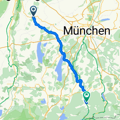
Althegnenberg-Königsbrunn
A cycling route starting in Althegnenberg, Bavaria, Germany.
Overview
About this route
Hochdorfer Straße 10, 82278 Althegnenberg
Monday, Thursday, Friday, Saturday, Sunday and public holidays 11:30 AM - 2 PM
- 3 h 53 min
- Duration
- 61.2 km
- Distance
- 387 m
- Ascent
- 388 m
- Descent
- 15.8 km/h
- Avg. speed
- 571 m
- Max. altitude

Route quality
Waytypes & surfaces along the route
Waytypes
Quiet road
29.4 km
(48 %)
Track
15.3 km
(25 %)
Surfaces
Paved
44.1 km
(72 %)
Unpaved
15.3 km
(25 %)
Asphalt
44.1 km
(72 %)
Loose gravel
8 km
(13 %)
Route highlights
Points of interest along the route
Accommodation after 34.9 km
Resi's Jägerhaus
Continue with Bikemap
Use, edit, or download this cycling route
You would like to ride Althegnenberg-Königsbrunn or customize it for your own trip? Here is what you can do with this Bikemap route:
Free features
- Save this route as favorite or in collections
- Copy & plan your own version of this route
- Sync your route with Garmin or Wahoo
Premium features
Free trial for 3 days, or one-time payment. More about Bikemap Premium.
- Navigate this route on iOS & Android
- Export a GPX / KML file of this route
- Create your custom printout (try it for free)
- Download this route for offline navigation
Discover more Premium features.
Get Bikemap PremiumFrom our community
Other popular routes starting in Althegnenberg
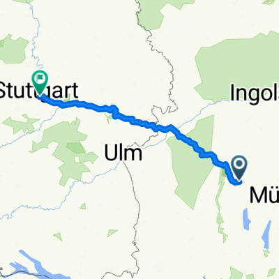
 Münchner Straße 16, Althegnenberg nach Kurt-Schumacher-Straße 48–62, Fürstenfeldbruck
- Distance
- 17.6 km
- Ascent
- 85 m
- Descent
- 90 m
- Location
- Althegnenberg, Bavaria, Germany
 Althegnenberg - Lenggries
- Distance
- 93.6 km
- Ascent
- 914 m
- Descent
- 772 m
- Location
- Althegnenberg, Bavaria, Germany
 ahbg jog
- Distance
- 4.2 km
- Ascent
- 28 m
- Descent
- 24 m
- Location
- Althegnenberg, Bavaria, Germany
 12345
12345- Distance
- 186.1 km
- Ascent
- 1,116 m
- Descent
- 1,340 m
- Location
- Althegnenberg, Bavaria, Germany
 Graf-Dux-Straße 2, Althegnenberg nach Augsburger Straße 18, Germering
- Distance
- 30.8 km
- Ascent
- 151 m
- Descent
- 153 m
- Location
- Althegnenberg, Bavaria, Germany
 Althegnenberg-Königsbrunn
- Distance
- 61.2 km
- Ascent
- 387 m
- Descent
- 388 m
- Location
- Althegnenberg, Bavaria, Germany
 Slow ride in Althegnenberg
- Distance
- 17.7 km
- Ascent
- 467 m
- Descent
- 463 m
- Location
- Althegnenberg, Bavaria, Germany
 Route nach Althegnenberger Straße 9C, Althegnenberg
- Distance
- 4.5 km
- Ascent
- 48 m
- Descent
- 34 m
- Location
- Althegnenberg, Bavaria, Germany
Open it in the app