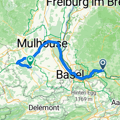
2017 Schlussetappe
A cycling route starting in Schwörstadt, Baden-Württemberg, Germany.
Overview
About this route
- -:--
- Duration
- 103.2 km
- Distance
- 384 m
- Ascent
- 248 m
- Descent
- ---
- Avg. speed
- ---
- Avg. speed
Route quality
Waytypes & surfaces along the route
Waytypes
Quiet road
26.1 km
(25 %)
Path
15.8 km
(15 %)
Surfaces
Paved
83.4 km
(81 %)
Unpaved
12.9 km
(12 %)
Asphalt
79.1 km
(77 %)
Gravel
11 km
(11 %)
Continue with Bikemap
Use, edit, or download this cycling route
You would like to ride 2017 Schlussetappe or customize it for your own trip? Here is what you can do with this Bikemap route:
Free features
- Save this route as favorite or in collections
- Copy & plan your own version of this route
- Sync your route with Garmin or Wahoo
Premium features
Free trial for 3 days, or one-time payment. More about Bikemap Premium.
- Navigate this route on iOS & Android
- Export a GPX / KML file of this route
- Create your custom printout (try it for free)
- Download this route for offline navigation
Discover more Premium features.
Get Bikemap PremiumFrom our community
Other popular routes starting in Schwörstadt
- Rundweg Wehr - Hasel - Dossenbach - Wallbach
- Distance
- 27.6 km
- Ascent
- 197 m
- Descent
- 197 m
- Location
- Schwörstadt, Baden-Württemberg, Germany
- 2017 Schlussetappe
- Distance
- 103.2 km
- Ascent
- 384 m
- Descent
- 248 m
- Location
- Schwörstadt, Baden-Württemberg, Germany
- Dinkelberg 1
- Distance
- 30.5 km
- Ascent
- 487 m
- Descent
- 493 m
- Location
- Schwörstadt, Baden-Württemberg, Germany
- Fuchswald
- Distance
- 72.3 km
- Ascent
- 1,209 m
- Descent
- 1,217 m
- Location
- Schwörstadt, Baden-Württemberg, Germany
- Sonnenbergroute über Bad Säckingen
- Distance
- 35.3 km
- Ascent
- 479 m
- Descent
- 479 m
- Location
- Schwörstadt, Baden-Württemberg, Germany
- Hauptstraße 157, Schwörstadt nach Hauptstraße 155, Schwörstadt
- Distance
- 40.6 km
- Ascent
- 335 m
- Descent
- 332 m
- Location
- Schwörstadt, Baden-Württemberg, Germany
- Stage 2 Sumer 2020
- Distance
- 57.3 km
- Ascent
- 214 m
- Descent
- 137 m
- Location
- Schwörstadt, Baden-Württemberg, Germany
- Rundweg Wehr - Hasel - Dossenbach - Wallbach
- Distance
- 27.6 km
- Ascent
- 212 m
- Descent
- 219 m
- Location
- Schwörstadt, Baden-Württemberg, Germany
Open it in the app