

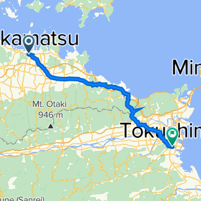
Takamatsu - Osayama camping
A cycling route starting in Takamatsu, Kagawa, Japan.
Overview
About this route
- -:--
- Duration
- 39.6 km
- Distance
- 492 m
- Ascent
- 101 m
- Descent
- ---
- Avg. speed
- ---
- Max. altitude

Route quality
Waytypes & surfaces along the route
Waytypes
Quiet road
19.8 km
(50 %)
Road
5.9 km
(15 %)
Surfaces
Paved
3.2 km
(8 %)
Unpaved
0.4 km
(1 %)
Asphalt
3.2 km
(8 %)
Unpaved (undefined)
0.4 km
(1 %)
Undefined
36 km
(91 %)
Continue with Bikemap
Use, edit, or download this cycling route
You would like to ride Takamatsu - Osayama camping or customize it for your own trip? Here is what you can do with this Bikemap route:
Free features
- Save this route as favorite or in collections
- Copy & plan your own version of this route
- Sync your route with Garmin or Wahoo
Premium features
Free trial for 3 days, or one-time payment. More about Bikemap Premium.
- Navigate this route on iOS & Android
- Export a GPX / KML file of this route
- Create your custom printout (try it for free)
- Download this route for offline navigation
Discover more Premium features.
Get Bikemap PremiumFrom our community
Other popular routes starting in Takamatsu
 8, Takamatsu to 637-2, Kotohira
- Distance
- 34.8 km
- Ascent
- 29 m
- Descent
- 8 m
- Location
- Takamatsu, Kagawa, Japan
 高松Takamatsu-德島Tokushima P-D1
- Distance
- 69.6 km
- Ascent
- 550 m
- Descent
- 553 m
- Location
- Takamatsu, Kagawa, Japan
 高松ルート
高松ルート- Distance
- 88.4 km
- Ascent
- 1,103 m
- Descent
- 1,100 m
- Location
- Takamatsu, Kagawa, Japan
 Shikoku trip day1
- Distance
- 32.9 km
- Ascent
- 104 m
- Descent
- 266 m
- Location
- Takamatsu, Kagawa, Japan
 Gosikidai see line
- Distance
- 39.5 km
- Ascent
- 223 m
- Descent
- 219 m
- Location
- Takamatsu, Kagawa, Japan
 Takamatsu - Marugame 30km
- Distance
- 29.5 km
- Ascent
- 54 m
- Descent
- 52 m
- Location
- Takamatsu, Kagawa, Japan
 Takamatsu to Himeji
- Distance
- 137.7 km
- Ascent
- 1,636 m
- Descent
- 1,623 m
- Location
- Takamatsu, Kagawa, Japan
 Takamatsu - Imabari
- Distance
- 159.5 km
- Ascent
- 305 m
- Descent
- 313 m
- Location
- Takamatsu, Kagawa, Japan
Open it in the app