

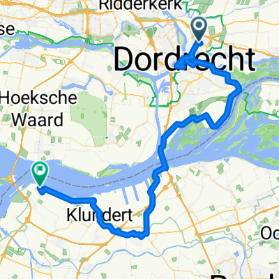
Rondje Papendrecht - Heinenoordtunnel - WIllemstad
A cycling route starting in Papendrecht, South Holland, The Netherlands.
Overview
About this route
100km rondje
- -:--
- Duration
- 102 km
- Distance
- 27 m
- Ascent
- 27 m
- Descent
- ---
- Avg. speed
- ---
- Max. altitude

Route quality
Waytypes & surfaces along the route
Waytypes
Cycleway
43.8 km
(43 %)
Quiet road
31.6 km
(31 %)
Surfaces
Paved
53 km
(52 %)
Asphalt
51 km
(50 %)
Paved (undefined)
2 km
(2 %)
Undefined
48.9 km
(48 %)
Continue with Bikemap
Use, edit, or download this cycling route
You would like to ride Rondje Papendrecht - Heinenoordtunnel - WIllemstad or customize it for your own trip? Here is what you can do with this Bikemap route:
Free features
- Save this route as favorite or in collections
- Copy & plan your own version of this route
- Split it into stages to create a multi-day tour
- Sync your route with Garmin or Wahoo
Premium features
Free trial for 3 days, or one-time payment. More about Bikemap Premium.
- Navigate this route on iOS & Android
- Export a GPX / KML file of this route
- Create your custom printout (try it for free)
- Download this route for offline navigation
Discover more Premium features.
Get Bikemap PremiumFrom our community
Other popular routes starting in Papendrecht
 Route 1
- Distance
- 46.1 km
- Ascent
- 4 m
- Descent
- 4 m
- Location
- Papendrecht, South Holland, The Netherlands
 Amsterdam Brügge: Station 3
- Distance
- 58.3 km
- Ascent
- 47 m
- Descent
- 48 m
- Location
- Papendrecht, South Holland, The Netherlands
 Molenkade 2015-08-11
- Distance
- 22.6 km
- Ascent
- 4 m
- Descent
- 4 m
- Location
- Papendrecht, South Holland, The Netherlands
 Bruggen en tunnels
- Distance
- 50 km
- Ascent
- 7 m
- Descent
- 10 m
- Location
- Papendrecht, South Holland, The Netherlands
 biesbosch 40km
- Distance
- 39.5 km
- Ascent
- 12 m
- Descent
- 12 m
- Location
- Papendrecht, South Holland, The Netherlands
 Westkil 44, Papendrecht do Westkil 44, Papendrecht
- Distance
- 24.8 km
- Ascent
- 50 m
- Descent
- 49 m
- Location
- Papendrecht, South Holland, The Netherlands
 P J Oudstraat 284, Papendrecht naar Dam 67–81, Alblasserdam
- Distance
- 5.8 km
- Ascent
- 16 m
- Descent
- 9 m
- Location
- Papendrecht, South Holland, The Netherlands
 Lekroute-4
- Distance
- 69.3 km
- Ascent
- 17 m
- Descent
- 17 m
- Location
- Papendrecht, South Holland, The Netherlands
Open it in the app