Short bike tour through Highlands Ranch
A cycling route starting in Highlands Ranch, Colorado, United States of America.
Overview
About this route
1st attempt to ride to work
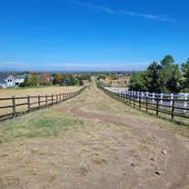
- -:--
- Duration
- 3.7 km
- Distance
- 15 m
- Ascent
- 66 m
- Descent
- ---
- Avg. speed
- ---
- Avg. speed
Route quality
Waytypes & surfaces along the route
Waytypes
Road
2.3 km
(62 %)
Quiet road
1.4 km
(38 %)
Surfaces
Paved
0.2 km
(5 %)
Asphalt
0.2 km
(5 %)
Undefined
3.5 km
(95 %)
Continue with Bikemap
Use, edit, or download this cycling route
You would like to ride Short bike tour through Highlands Ranch or customize it for your own trip? Here is what you can do with this Bikemap route:
Free features
- Save this route as favorite or in collections
- Copy & plan your own version of this route
- Sync your route with Garmin or Wahoo
Premium features
Free trial for 3 days, or one-time payment. More about Bikemap Premium.
- Navigate this route on iOS & Android
- Export a GPX / KML file of this route
- Create your custom printout (try it for free)
- Download this route for offline navigation
Discover more Premium features.
Get Bikemap PremiumFrom our community
Other popular routes starting in Highlands Ranch
- Skyreach Road 10541, Littleton to Skyreach Road 10541, Littleton
- Distance
- 42.1 km
- Ascent
- 403 m
- Descent
- 396 m
- Location
- Highlands Ranch, Colorado, United States of America
- Daniels Parker Kalmon Loop out and back
- Distance
- 90.5 km
- Ascent
- 689 m
- Descent
- 687 m
- Location
- Highlands Ranch, Colorado, United States of America
- Monarch
- Distance
- 48.1 km
- Ascent
- 893 m
- Descent
- 893 m
- Location
- Highlands Ranch, Colorado, United States of America
- Deer Creek Conifer Evergreen loop
- Distance
- 101.3 km
- Ascent
- 1,583 m
- Descent
- 1,595 m
- Location
- Highlands Ranch, Colorado, United States of America
- East of the house to Lone Tree
- Distance
- 14.9 km
- Ascent
- 3,715 m
- Descent
- 3,718 m
- Location
- Highlands Ranch, Colorado, United States of America
- Castle Rock, Parker Rundfahrt
- Distance
- 62.5 km
- Ascent
- 512 m
- Descent
- 512 m
- Location
- Highlands Ranch, Colorado, United States of America
- Painted Canyon Circle 9451, Littleton to High Cliffe Place 2801, Littleton
- Distance
- 17.2 km
- Ascent
- 138 m
- Descent
- 120 m
- Location
- Highlands Ranch, Colorado, United States of America
- 2000 E County Line Rd, Highlands Ranch to 1601 Wynkoop St, Denver
- Distance
- 29.2 km
- Ascent
- 67 m
- Descent
- 226 m
- Location
- Highlands Ranch, Colorado, United States of America
Open it in the app