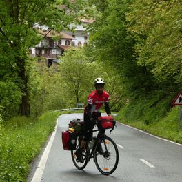
Sigüenza - Valle del río Salado - Sigüenza
A cycling route starting in Siguenza, Castille-La Mancha, Spain.
Overview
About this route
Challenging route with two points where it is practically impossible not to put a foot down:
-
One is the crossing of the tail of the Atance Reservoir in Santamera (either you cross it using an existing ford by following the path that leaves from the cemetery on the left bank or you cross the river via the bridge in the village (to the right of the main street) and go down dismounted along a path and rocks on the right bank bordering the river, an option I followed and got my feet wet).
-
The other point is at the end of climbing the Barranco de Viana de Jadraque, where you have to take a non-cyclable path to the right for about 500 m.
Other than that, it is a beautiful route with two impressive natural points (Hoz de Santamera and Barranco de Viana de Jadraque) and several sites of architectural and cultural heritage (Sigüenza 'capital' and Palazuelos-La Olmeda).
- -:--
- Duration
- 50.5 km
- Distance
- 513 m
- Ascent
- 514 m
- Descent
- ---
- Avg. speed
- ---
- Max. altitude
Route photos
Continue with Bikemap
Use, edit, or download this cycling route
You would like to ride Sigüenza - Valle del río Salado - Sigüenza or customize it for your own trip? Here is what you can do with this Bikemap route:
Free features
- Save this route as favorite or in collections
- Copy & plan your own version of this route
- Sync your route with Garmin or Wahoo
Premium features
Free trial for 3 days, or one-time payment. More about Bikemap Premium.
- Navigate this route on iOS & Android
- Export a GPX / KML file of this route
- Create your custom printout (try it for free)
- Download this route for offline navigation
Discover more Premium features.
Get Bikemap PremiumFrom our community
Other popular routes starting in Siguenza
 Sigüenza - Valle del río Salado - Sigüenza
- Distance
- 50.5 km
- Ascent
- 513 m
- Descent
- 514 m
- Location
- Siguenza, Castille-La Mancha, Spain
 Zum See
- Distance
- 54.6 km
- Ascent
- 750 m
- Descent
- 482 m
- Location
- Siguenza, Castille-La Mancha, Spain
 Sigüenza Alcalá de Henares por Camino del Cid
- Distance
- 137.4 km
- Ascent
- 481 m
- Descent
- 870 m
- Location
- Siguenza, Castille-La Mancha, Spain
 Sigüenza - Estriegana - Cubillas - Horna - Sigúenza
- Distance
- 38.9 km
- Ascent
- 302 m
- Descent
- 302 m
- Location
- Siguenza, Castille-La Mancha, Spain
 Nuevalos
- Distance
- 97.4 km
- Ascent
- 1,564 m
- Descent
- 1,849 m
- Location
- Siguenza, Castille-La Mancha, Spain
 Day 20
- Distance
- 100.6 km
- Ascent
- 834 m
- Descent
- 841 m
- Location
- Siguenza, Castille-La Mancha, Spain
 Tajo Celtibero
- Distance
- 227.9 km
- Ascent
- 1,497 m
- Descent
- 1,500 m
- Location
- Siguenza, Castille-La Mancha, Spain
 LOS DOS RIOS
- Distance
- 31.2 km
- Ascent
- 380 m
- Descent
- 382 m
- Location
- Siguenza, Castille-La Mancha, Spain
Open it in the app


