

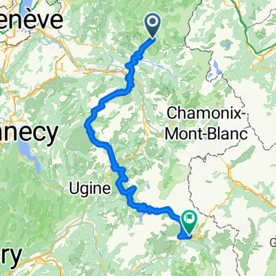
2017 Alps 1
A cycling route starting in Les Gets, Auvergne-Rhône-Alpes, France.
Overview
About this route
Encrenevaz, Ramaz, Joux PLane, Joux Vert
- -:--
- Duration
- 112.9 km
- Distance
- 2,874 m
- Ascent
- 2,864 m
- Descent
- ---
- Avg. speed
- ---
- Max. altitude

Route quality
Waytypes & surfaces along the route
Waytypes
Road
70 km
(62 %)
Quiet road
5.6 km
(5 %)
Surfaces
Paved
94.9 km
(84 %)
Unpaved
3.4 km
(3 %)
Asphalt
92.6 km
(82 %)
Concrete
2.3 km
(2 %)
Continue with Bikemap
Use, edit, or download this cycling route
You would like to ride 2017 Alps 1 or customize it for your own trip? Here is what you can do with this Bikemap route:
Free features
- Save this route as favorite or in collections
- Copy & plan your own version of this route
- Split it into stages to create a multi-day tour
- Sync your route with Garmin or Wahoo
Premium features
Free trial for 3 days, or one-time payment. More about Bikemap Premium.
- Navigate this route on iOS & Android
- Export a GPX / KML file of this route
- Create your custom printout (try it for free)
- Download this route for offline navigation
Discover more Premium features.
Get Bikemap PremiumFrom our community
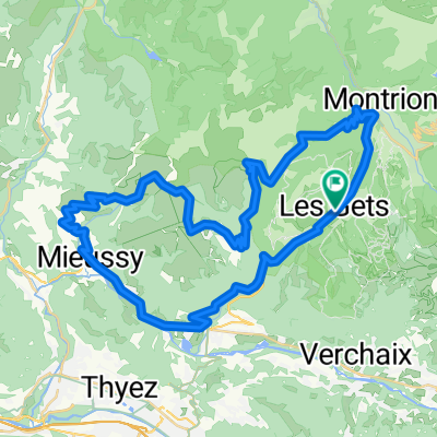
Other popular routes starting in Les Gets
 2017 Alps 2
- Distance
- 151.8 km
- Ascent
- 3,852 m
- Descent
- 4,052 m
- Location
- Les Gets, Auvergne-Rhône-Alpes, France
 Col de l'encrenaz
- Distance
- 26.8 km
- Ascent
- 763 m
- Descent
- 763 m
- Location
- Les Gets, Auvergne-Rhône-Alpes, France
 6. Etappe: Les Gets - Col des Aravis
- Distance
- 65.8 km
- Ascent
- 1,668 m
- Descent
- 1,605 m
- Location
- Les Gets, Auvergne-Rhône-Alpes, France
 2017 Alps 1
- Distance
- 112.9 km
- Ascent
- 2,874 m
- Descent
- 2,864 m
- Location
- Les Gets, Auvergne-Rhône-Alpes, France
 Les Gets - col d'Ecrenaz, les chavannes
- Distance
- 34.6 km
- Ascent
- 1,051 m
- Descent
- 1,051 m
- Location
- Les Gets, Auvergne-Rhône-Alpes, France
 joux plane - joux verte - col de l'encrenaz
- Distance
- 86.7 km
- Ascent
- 2,857 m
- Descent
- 2,858 m
- Location
- Les Gets, Auvergne-Rhône-Alpes, France
 Les Gets - Ramaz - Encrenaz
- Distance
- 56.3 km
- Ascent
- 1,437 m
- Descent
- 1,434 m
- Location
- Les Gets, Auvergne-Rhône-Alpes, France
 Day 2
Day 2- Distance
- 158.9 km
- Ascent
- 3,540 m
- Descent
- 3,279 m
- Location
- Les Gets, Auvergne-Rhône-Alpes, France
Open it in the app