

1000miles2015cz.gpx
A cycling route starting in Štítná nad Vláří, Zlín, Czechia.
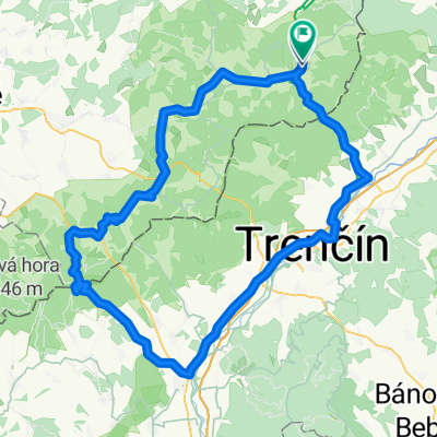
Overview
About this route
TAHUNA track
- -:--
- Duration
- 962.3 km
- Distance
- 4,760 m
- Ascent
- 4,987 m
- Descent
- ---
- Avg. speed
- ---
- Max. altitude

Route highlights
Points of interest along the route
Point of interest after 1.8 km
přechod česko-slovenské hranice
Point of interest after 234.2 km
Finish 500 / CP 2 Partner cíle: PS Assistance www.psassistance.cz
Point of interest after 556.7 km
Kontrolní stanoviště CP 3 Partner kontroly: Lannutti www.lannutti.com
Continue with Bikemap
Use, edit, or download this cycling route
You would like to ride 1000miles2015cz.gpx or customize it for your own trip? Here is what you can do with this Bikemap route:
Free features
- Save this route as favorite or in collections
- Copy & plan your own version of this route
- Split it into stages to create a multi-day tour
- Sync your route with Garmin or Wahoo
Premium features
Free trial for 3 days, or one-time payment. More about Bikemap Premium.
- Navigate this route on iOS & Android
- Export a GPX / KML file of this route
- Create your custom printout (try it for free)
- Download this route for offline navigation
Discover more Premium features.
Get Bikemap PremiumFrom our community
Other popular routes starting in Štítná nad Vláří
 Přejezd Bílých Karpat
- Distance
- 101.2 km
- Ascent
- 1,171 m
- Descent
- 1,300 m
- Location
- Štítná nad Vláří, Zlín, Czechia
 Kochavec-Svatý Štěpán-Chladný vrch
- Distance
- 21.3 km
- Ascent
- 402 m
- Descent
- 340 m
- Location
- Štítná nad Vláří, Zlín, Czechia
 2015.06.06 vysielač nad Nedašovom
- Distance
- 26.7 km
- Ascent
- 516 m
- Descent
- 516 m
- Location
- Štítná nad Vláří, Zlín, Czechia
 Inline Brumov-Bylnice
- Distance
- 1.9 km
- Ascent
- 27 m
- Descent
- 8 m
- Location
- Štítná nad Vláří, Zlín, Czechia
 1000 miles SR
- Distance
- 543.3 km
- Ascent
- 5,198 m
- Descent
- 5,443 m
- Location
- Štítná nad Vláří, Zlín, Czechia
 2019_04 Bylnice_Valašské Příkazy pěšky
- Distance
- 18.9 km
- Ascent
- 697 m
- Descent
- 559 m
- Location
- Štítná nad Vláří, Zlín, Czechia
 Na Javořinu
- Distance
- 128.9 km
- Ascent
- 1,443 m
- Descent
- 1,438 m
- Location
- Štítná nad Vláří, Zlín, Czechia
 Luhačovice?kladná-Žilín,Bojkovice
- Distance
- 69.7 km
- Ascent
- 805 m
- Descent
- 811 m
- Location
- Štítná nad Vláří, Zlín, Czechia
Open it in the app