

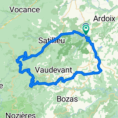
Saint-Jeure-d'Ay Col du Juvenet par les Hubas
A cycling route starting in Quintenas, Auvergne-Rhône-Alpes, France.
Overview
About this route
- 2 h 34 min
- Duration
- 21.7 km
- Distance
- 357 m
- Ascent
- 357 m
- Descent
- 8.5 km/h
- Avg. speed
- ---
- Max. altitude

Route quality
Waytypes & surfaces along the route
Waytypes
Quiet road
20.4 km
(94 %)
Track
0.4 km
(2 %)
Undefined
0.9 km
(4 %)
Surfaces
Unpaved
0.4 km
(2 %)
Ground
0.4 km
(2 %)
Undefined
21.3 km
(98 %)
Continue with Bikemap
Use, edit, or download this cycling route
You would like to ride Saint-Jeure-d'Ay Col du Juvenet par les Hubas or customize it for your own trip? Here is what you can do with this Bikemap route:
Free features
- Save this route as favorite or in collections
- Copy & plan your own version of this route
- Sync your route with Garmin or Wahoo
Premium features
Free trial for 3 days, or one-time payment. More about Bikemap Premium.
- Navigate this route on iOS & Android
- Export a GPX / KML file of this route
- Create your custom printout (try it for free)
- Download this route for offline navigation
Discover more Premium features.
Get Bikemap PremiumFrom our community
Other popular routes starting in Quintenas
 Ardoix - Lamastre
- Distance
- 52.1 km
- Ascent
- 886 m
- Descent
- 818 m
- Location
- Quintenas, Auvergne-Rhône-Alpes, France
 balade St jeure 2018-06-02
- Distance
- 7.9 km
- Ascent
- 748 m
- Descent
- 738 m
- Location
- Quintenas, Auvergne-Rhône-Alpes, France
 Lengthy ride through Étables
- Distance
- 54.6 km
- Ascent
- 632 m
- Descent
- 612 m
- Location
- Quintenas, Auvergne-Rhône-Alpes, France
 Saint-Jeure-d'Ay Col du Juvenet par les Hubas
- Distance
- 21.7 km
- Ascent
- 357 m
- Descent
- 357 m
- Location
- Quintenas, Auvergne-Rhône-Alpes, France
 De Rue de Valernaud 25, Quintenas à Quai d'Amérique 6001, Calais
- Distance
- 1,295.7 km
- Ascent
- 4,521 m
- Descent
- 4,888 m
- Location
- Quintenas, Auvergne-Rhône-Alpes, France
 balade 2019.02.22
- Distance
- 8.9 km
- Ascent
- 378 m
- Descent
- 351 m
- Location
- Quintenas, Auvergne-Rhône-Alpes, France
 lalouvesc
- Distance
- 57 km
- Ascent
- 1,727 m
- Descent
- 1,730 m
- Location
- Quintenas, Auvergne-Rhône-Alpes, France
 roche des vents
- Distance
- 28.2 km
- Ascent
- 835 m
- Descent
- 480 m
- Location
- Quintenas, Auvergne-Rhône-Alpes, France
Open it in the app