

HAUTE ROUTE DOLOMITES Day 5
A cycling route starting in Cencenighe Agordino, Veneto, Italy.
Overview
About this route
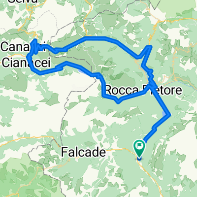
Cencenighe Agordino-Passo San Boldo(706nm)-Treviso-Venice 135 km, 690 vm
- -:--
- Duration
- 135 km
- Distance
- 396 m
- Ascent
- 1,166 m
- Descent
- ---
- Avg. speed
- ---
- Max. altitude

Route quality
Waytypes & surfaces along the route
Waytypes
Quiet road
36.5 km
(27 %)
Road
14.9 km
(11 %)
Surfaces
Paved
98.6 km
(73 %)
Unpaved
2.7 km
(2 %)
Asphalt
93.2 km
(69 %)
Paved (undefined)
5.4 km
(4 %)
Continue with Bikemap
Use, edit, or download this cycling route
You would like to ride HAUTE ROUTE DOLOMITES Day 5 or customize it for your own trip? Here is what you can do with this Bikemap route:
Free features
- Save this route as favorite or in collections
- Copy & plan your own version of this route
- Split it into stages to create a multi-day tour
- Sync your route with Garmin or Wahoo
Premium features
Free trial for 3 days, or one-time payment. More about Bikemap Premium.
- Navigate this route on iOS & Android
- Export a GPX / KML file of this route
- Create your custom printout (try it for free)
- Download this route for offline navigation
Discover more Premium features.
Get Bikemap PremiumFrom our community
Other popular routes starting in Cencenighe Agordino
 Cencenighe - Passo Fedaia - Passo Pordoi - Cencenighe
- Distance
- 96 km
- Ascent
- 2,137 m
- Descent
- 2,137 m
- Location
- Cencenighe Agordino, Veneto, Italy
 Cencenighe, Giau, 3 Cime di Lavaredo, Falzarego
- Distance
- 138.1 km
- Ascent
- 3,646 m
- Descent
- 3,644 m
- Location
- Cencenighe Agordino, Veneto, Italy
 falcade rolle
- Distance
- 95 km
- Ascent
- 2,539 m
- Descent
- 2,541 m
- Location
- Cencenighe Agordino, Veneto, Italy
 Da Statale 203, Cencenighe Agordino a Piazza Municipio 10, Falcade
- Distance
- 9.2 km
- Ascent
- 487 m
- Descent
- 146 m
- Location
- Cencenighe Agordino, Veneto, Italy
 Caprile - Valles - Rolle - Cereda - Aurino - Agordo - Caprile
- Distance
- 89.9 km
- Ascent
- 2,630 m
- Descent
- 2,628 m
- Location
- Cencenighe Agordino, Veneto, Italy
 HAUTE ROUTE DOLOMITES Day 5
- Distance
- 135 km
- Ascent
- 396 m
- Descent
- 1,166 m
- Location
- Cencenighe Agordino, Veneto, Italy
 Cencenighe - Caprile - San Tomaso - Cencenighe
- Distance
- 40.4 km
- Ascent
- 635 m
- Descent
- 636 m
- Location
- Cencenighe Agordino, Veneto, Italy
 Borghi Falcade
- Distance
- 43.4 km
- Ascent
- 1,756 m
- Descent
- 1,761 m
- Location
- Cencenighe Agordino, Veneto, Italy
Open it in the app