

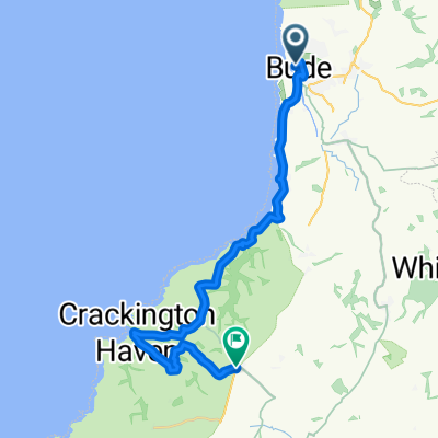
LEJOG_D2
A cycling route starting in Flexbury, England, United Kingdom.
Overview
About this route
- -:--
- Duration
- 165.4 km
- Distance
- 947 m
- Ascent
- 1,104 m
- Descent
- ---
- Avg. speed
- ---
- Max. altitude

Route quality
Waytypes & surfaces along the route
Waytypes
Quiet road
62.9 km
(38 %)
Road
44.7 km
(27 %)
Surfaces
Paved
52.9 km
(32 %)
Unpaved
1.7 km
(1 %)
Asphalt
41.4 km
(25 %)
Paved (undefined)
11.6 km
(7 %)
Route highlights
Points of interest along the route
Accommodation after 0.2 km
Campsite #1 Tamar Lake Farm Camping & Caravan Site camping-incornwall.co.uk
Accommodation after 72.8 km
Campsite #4 Gwerniago Campsite gwerniago.co.uk
Accommodation after 164.9 km
Campsite #9 Glen Nevis Caravan & Camping Park glen-nevis.co.uk
Accommodation after 165.4 km
Campsite #3 Cypress Farm Caravan Site http://cypress-farm.co.uk/
Accommodation after 165.4 km
Campsite #6: Oakhead Caravan Park http://www.oakheadcaravanpark.co.uk/booking.html
Accommodation after 165.4 km
Campsite #10 Dunroamin Caravan Park lairgcaravanpark.co.uk
Accommodation after 165.4 km
Campsite #5 Lady Heyes Park ladyheyespark.com
Accommodation after 165.4 km
Campsite #7 Barnsoul Caravan Park barnsoulcaravanpark.co.uk
Accommodation after 165.4 km
Campsite #8 Lagganbeg Caravan Park lagganbeg.co.uk
Continue with Bikemap
Use, edit, or download this cycling route
You would like to ride LEJOG_D2 or customize it for your own trip? Here is what you can do with this Bikemap route:
Free features
- Save this route as favorite or in collections
- Copy & plan your own version of this route
- Split it into stages to create a multi-day tour
- Sync your route with Garmin or Wahoo
Premium features
Free trial for 3 days, or one-time payment. More about Bikemap Premium.
- Navigate this route on iOS & Android
- Export a GPX / KML file of this route
- Create your custom printout (try it for free)
- Download this route for offline navigation
Discover more Premium features.
Get Bikemap PremiumFrom our community
Other popular routes starting in Flexbury
 Wooda Farm Park to Crackington Manor
- Distance
- 22.1 km
- Ascent
- 451 m
- Descent
- 481 m
- Location
- Flexbury, England, United Kingdom
 Tintagel 23 km
- Distance
- 22.3 km
- Ascent
- 523 m
- Descent
- 362 m
- Location
- Flexbury, England, United Kingdom
 Lejog 2016 - Day 2 - Bude - Bridgwater
- Distance
- 148.9 km
- Ascent
- 1,161 m
- Descent
- 1,163 m
- Location
- Flexbury, England, United Kingdom
 south inland loop
- Distance
- 10.3 km
- Ascent
- 512 m
- Descent
- 516 m
- Location
- Flexbury, England, United Kingdom
 Sandymouth - Bude - Sandymouth
- Distance
- 10.6 km
- Ascent
- 64 m
- Descent
- 153 m
- Location
- Flexbury, England, United Kingdom
 10 mile loop
- Distance
- 15.2 km
- Ascent
- 302 m
- Descent
- 302 m
- Location
- Flexbury, England, United Kingdom
 MJR2
MJR2- Distance
- 121.6 km
- Ascent
- 1,128 m
- Descent
- 1,027 m
- Location
- Flexbury, England, United Kingdom
 Crooklets Road nach Marine Drive
- Distance
- 4.7 km
- Ascent
- 94 m
- Descent
- 81 m
- Location
- Flexbury, England, United Kingdom
Open it in the app