

Boulogne Chatillon Boulogne 220Km
A cycling route starting in Saint-Léger-en-Yvelines, Île-de-France Region, France.
Overview
About this route
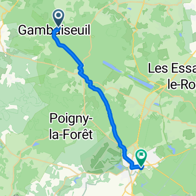
Boulogne
Chatillon
Boulogne
- -:--
- Duration
- 213.5 km
- Distance
- 708 m
- Ascent
- 707 m
- Descent
- ---
- Avg. speed
- ---
- Max. altitude

Continue with Bikemap
Use, edit, or download this cycling route
You would like to ride Boulogne Chatillon Boulogne 220Km or customize it for your own trip? Here is what you can do with this Bikemap route:
Free features
- Save this route as favorite or in collections
- Copy & plan your own version of this route
- Split it into stages to create a multi-day tour
- Sync your route with Garmin or Wahoo
Premium features
Free trial for 3 days, or one-time payment. More about Bikemap Premium.
- Navigate this route on iOS & Android
- Export a GPX / KML file of this route
- Create your custom printout (try it for free)
- Download this route for offline navigation
Discover more Premium features.
Get Bikemap PremiumFrom our community
Other popular routes starting in Saint-Léger-en-Yvelines
 Itinéraire à partir de Les Étangs de Hollande, Les Bréviaires
- Distance
- 34.4 km
- Ascent
- 1,328 m
- Descent
- 1,332 m
- Location
- Saint-Léger-en-Yvelines, Île-de-France Region, France
 Rue de la Croix Blanche 17, Saint-Léger-en-Yvelines nach Avenue du Général de Gaulle 3443, La Ferté-Bernard
- Distance
- 114 km
- Ascent
- 1,136 m
- Descent
- 1,189 m
- Location
- Saint-Léger-en-Yvelines, Île-de-France Region, France
 La Rambolitaine - 2114 - modifié
- Distance
- 39.3 km
- Ascent
- 336 m
- Descent
- 335 m
- Location
- Saint-Léger-en-Yvelines, Île-de-France Region, France
 Route de Montfort-l'Amaury, Gambaiseuil naar Rue de la Giroderie, Rambouillet
- Distance
- 18.6 km
- Ascent
- 145 m
- Descent
- 138 m
- Location
- Saint-Léger-en-Yvelines, Île-de-France Region, France
 20170612_141011.gpx
- Distance
- 35.6 km
- Ascent
- 259 m
- Descent
- 258 m
- Location
- Saint-Léger-en-Yvelines, Île-de-France Region, France
 De Route du Petit et Haut Choisel, Gambaiseuil à Route du Petit et Haut Choisel, Gambaiseuil
- Distance
- 14.3 km
- Ascent
- 184 m
- Descent
- 192 m
- Location
- Saint-Léger-en-Yvelines, Île-de-France Region, France
 62 km -
- Distance
- 62.8 km
- Ascent
- 337 m
- Descent
- 338 m
- Location
- Saint-Léger-en-Yvelines, Île-de-France Region, France
 Boulogne Chatillon Boulogne 220Km
- Distance
- 213.5 km
- Ascent
- 708 m
- Descent
- 707 m
- Location
- Saint-Léger-en-Yvelines, Île-de-France Region, France
Open it in the app