

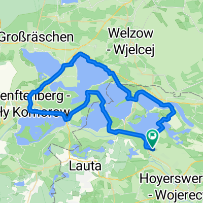
HY-SPB-HY
A cycling route starting in Hoyerswerda, Saxony, Germany.
Overview
About this route
HY - Schwarzkollm - Laubusch - Lieske - Welzow - Steinitz - Paproth - Rehnsdorf - Döbbern - Groß Oßnig - Stausee - SPB - Spreeradweg - Scheibesee - HY
- -:--
- Duration
- 92.7 km
- Distance
- 247 m
- Ascent
- 245 m
- Descent
- ---
- Avg. speed
- ---
- Max. altitude

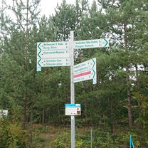
Route photos

Route quality
Waytypes & surfaces along the route
Waytypes
Road
21.3 km
(23 %)
Quiet road
21.3 km
(23 %)
Surfaces
Paved
69.5 km
(75 %)
Unpaved
0.9 km
(1 %)
Asphalt
67.7 km
(73 %)
Paved (undefined)
1.9 km
(2 %)
Route highlights
Points of interest along the route

Point of interest after 32.8 km
Welzower Fenster

Point of interest after 41.4 km
Steinitz

Point of interest after 59.6 km
Mittagessen im Storchennest
Continue with Bikemap
Use, edit, or download this cycling route
You would like to ride HY-SPB-HY or customize it for your own trip? Here is what you can do with this Bikemap route:
Free features
- Save this route as favorite or in collections
- Copy & plan your own version of this route
- Split it into stages to create a multi-day tour
- Sync your route with Garmin or Wahoo
Premium features
Free trial for 3 days, or one-time payment. More about Bikemap Premium.
- Navigate this route on iOS & Android
- Export a GPX / KML file of this route
- Create your custom printout (try it for free)
- Download this route for offline navigation
Discover more Premium features.
Get Bikemap PremiumFrom our community
Other popular routes starting in Hoyerswerda
 Rundfahrt um den Koschenberg/Triathlonstrecke
- Distance
- 12.9 km
- Ascent
- 36 m
- Descent
- 24 m
- Location
- Hoyerswerda, Saxony, Germany
 Runde Scheibe-See Bernsteinsee
- Distance
- 26.9 km
- Ascent
- 306 m
- Descent
- 331 m
- Location
- Hoyerswerda, Saxony, Germany
 Scheibesee
- Distance
- 13.2 km
- Ascent
- 37 m
- Descent
- 37 m
- Location
- Hoyerswerda, Saxony, Germany
 HY-SPB-HY
- Distance
- 92.7 km
- Ascent
- 247 m
- Descent
- 245 m
- Location
- Hoyerswerda, Saxony, Germany
 Seenland 100 (2009) - 120km RTF CLONED FROM ROUTE 257265
- Distance
- 123.8 km
- Ascent
- 183 m
- Descent
- 183 m
- Location
- Hoyerswerda, Saxony, Germany
 Bahnhofsallee 3, Hoyerswerda nach Unnamed Road, Hoyerswerda
- Distance
- 8.9 km
- Ascent
- 13 m
- Descent
- 49 m
- Location
- Hoyerswerda, Saxony, Germany
 Wolfikovo malý jezerní okruh - Scheibe see
- Distance
- 13.3 km
- Ascent
- 32 m
- Descent
- 34 m
- Location
- Hoyerswerda, Saxony, Germany
 Geierswalder Straße, Elsterheide nach Geierswalder Straße, Elsterheide
- Distance
- 56.7 km
- Ascent
- 104 m
- Descent
- 104 m
- Location
- Hoyerswerda, Saxony, Germany
Open it in the app