Etappe_06_bike
A cycling route starting in Dettelbach, Bavaria, Germany.
Overview
About this route
- -:--
- Duration
- 46.2 km
- Distance
- 70 m
- Ascent
- 106 m
- Descent
- ---
- Avg. speed
- ---
- Max. altitude
Route quality
Waytypes & surfaces along the route
Waytypes
Path
18 km
(39 %)
Quiet road
10.9 km
(24 %)
Surfaces
Paved
45.1 km
(98 %)
Asphalt
43.6 km
(94 %)
Paving stones
1.1 km
(2 %)
Route highlights
Points of interest along the route
Point of interest after 45.7 km
Abzweig_06
Continue with Bikemap
Use, edit, or download this cycling route
You would like to ride Etappe_06_bike or customize it for your own trip? Here is what you can do with this Bikemap route:
Free features
- Save this route as favorite or in collections
- Copy & plan your own version of this route
- Sync your route with Garmin or Wahoo
Premium features
Free trial for 3 days, or one-time payment. More about Bikemap Premium.
- Navigate this route on iOS & Android
- Export a GPX / KML file of this route
- Create your custom printout (try it for free)
- Download this route for offline navigation
Discover more Premium features.
Get Bikemap PremiumFrom our community
Other popular routes starting in Dettelbach
- B22, Schwarzach am Main nach Schweinfurter Straße 97, Schwarzach am Main
- Distance
- 25.8 km
- Ascent
- 100 m
- Descent
- 96 m
- Location
- Dettelbach, Bavaria, Germany
- Dettelb- Route 1 kurz
- Distance
- 17.1 km
- Ascent
- 194 m
- Descent
- 195 m
- Location
- Dettelbach, Bavaria, Germany
- Mainschleife: Mainsondheim-Volkach retour
- Distance
- 33.3 km
- Ascent
- 210 m
- Descent
- 210 m
- Location
- Dettelbach, Bavaria, Germany
- Dettelbach - Retzstadt
- Distance
- 70.9 km
- Ascent
- 109 m
- Descent
- 73 m
- Location
- Dettelbach, Bavaria, Germany
- Tag 4 Dettelbach/Bad Bocklet
- Distance
- 73.8 km
- Ascent
- 301 m
- Descent
- 260 m
- Location
- Dettelbach, Bavaria, Germany
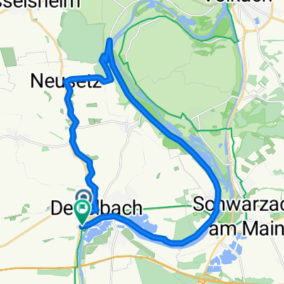
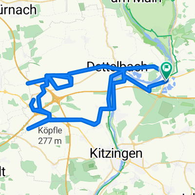
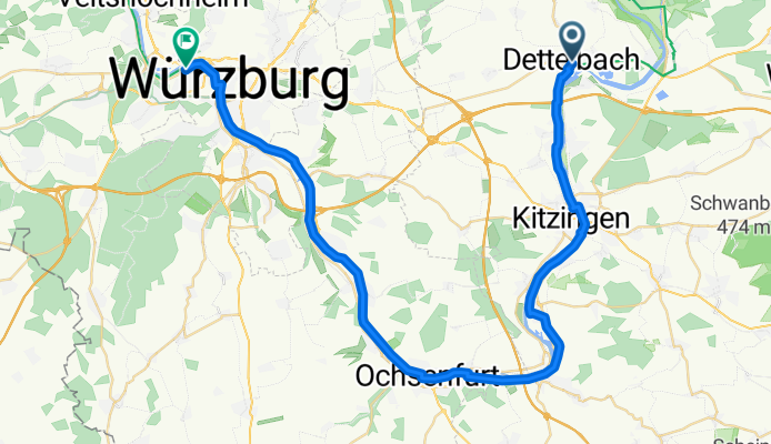
- Dettelbach in den Steigerwald
- Distance
- 67.5 km
- Ascent
- 767 m
- Descent
- 754 m
- Location
- Dettelbach, Bavaria, Germany
- Kripo Radtour 2014 - 2. Tag
- Distance
- 47 km
- Ascent
- 352 m
- Descent
- 258 m
- Location
- Dettelbach, Bavaria, Germany
- Dettelbach längs dem Main nach Würzburg und zurück durchs Land
- Distance
- 64.8 km
- Ascent
- 399 m
- Descent
- 300 m
- Location
- Dettelbach, Bavaria, Germany
Open it in the app