

East coast and down
A cycling route starting in Gaylord, Michigan, United States.
Overview
About this route
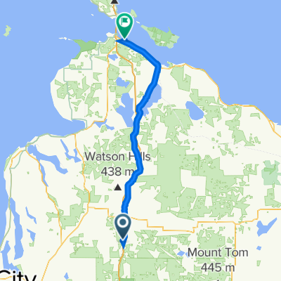
Biking from Gaylord Michigan to Prince Edward Island then down to Key West.
- -:--
- Duration
- 2,648.4 km
- Distance
- 1,002 m
- Ascent
- 1,394 m
- Descent
- ---
- Avg. speed
- ---
- Max. altitude

Continue with Bikemap
Use, edit, or download this cycling route
You would like to ride East coast and down or customize it for your own trip? Here is what you can do with this Bikemap route:
Free features
- Save this route as favorite or in collections
- Copy & plan your own version of this route
- Split it into stages to create a multi-day tour
- Sync your route with Garmin or Wahoo
Premium features
Free trial for 3 days, or one-time payment. More about Bikemap Premium.
- Navigate this route on iOS & Android
- Export a GPX / KML file of this route
- Create your custom printout (try it for free)
- Download this route for offline navigation
Discover more Premium features.
Get Bikemap PremiumFrom our community
Other popular routes starting in Gaylord
 Long bike tour from Gaylord MI to Standish,MI
- Distance
- 160.9 km
- Ascent
- 211 m
- Descent
- 420 m
- Location
- Gaylord, Michigan, United States
 East Main Street 114, Gaylord to Brookford Drive 2303, Toledo
- Distance
- 501.3 km
- Ascent
- 1,324 m
- Descent
- 1,544 m
- Location
- Gaylord, Michigan, United States
 East coast and down
- Distance
- 2,648.4 km
- Ascent
- 1,002 m
- Descent
- 1,394 m
- Location
- Gaylord, Michigan, United States
 Mackinaw City Day 4
- Distance
- 113.6 km
- Ascent
- 503 m
- Descent
- 721 m
- Location
- Gaylord, Michigan, United States
 565 Crestwood Dr, Gaylord to 565 Crestwood Dr, Gaylord
- Distance
- 14.1 km
- Ascent
- 67 m
- Descent
- 76 m
- Location
- Gaylord, Michigan, United States
 Route from Jackson Alley, Gaylord
- Distance
- 111.8 km
- Ascent
- 279 m
- Descent
- 494 m
- Location
- Gaylord, Michigan, United States
 Recovered Route
- Distance
- 68.3 km
- Ascent
- 203 m
- Descent
- 409 m
- Location
- Gaylord, Michigan, United States
 DALMAC 2009 4 day east - Day 4 CLONED FROM ROUTE 308652
- Distance
- 107.7 km
- Ascent
- 178 m
- Descent
- 405 m
- Location
- Gaylord, Michigan, United States
Open it in the app