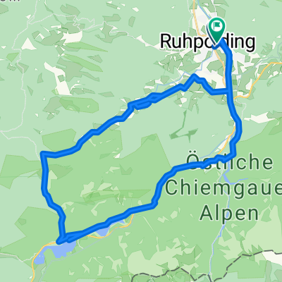
Von Ruhpolding zum Drei-Seen-Gebiet
A cycling route starting in Ruhpolding, Bavaria, Germany.
Overview
About this route
Tour 25 aus Radwandern und Mountainbiken
- -:--
- Duration
- 36.5 km
- Distance
- ---
- Ascent
- ---
- Descent
- ---
- Avg. speed
- ---
- Max. altitude
Route quality
Waytypes & surfaces along the route
Waytypes
Track
25.4 km
(70 %)
Path
4.9 km
(13 %)
Surfaces
Paved
6.2 km
(17 %)
Unpaved
29.9 km
(82 %)
Gravel
28.7 km
(79 %)
Asphalt
5.9 km
(16 %)
Continue with Bikemap
Use, edit, or download this cycling route
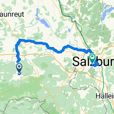
You would like to ride Von Ruhpolding zum Drei-Seen-Gebiet or customize it for your own trip? Here is what you can do with this Bikemap route:
Free features
- Save this route as favorite or in collections
- Copy & plan your own version of this route
- Sync your route with Garmin or Wahoo
Premium features
Free trial for 3 days, or one-time payment. More about Bikemap Premium.
- Navigate this route on iOS & Android
- Export a GPX / KML file of this route
- Create your custom printout (try it for free)
- Download this route for offline navigation
Discover more Premium features.
Get Bikemap PremiumFrom our community
Other popular routes starting in Ruhpolding
- Rauschbergrunde
- Distance
- 26.4 km
- Ascent
- 588 m
- Descent
- 588 m
- Location
- Ruhpolding, Bavaria, Germany
- D_Bayern-Fuchsau-Gstatt-Steinbachalm-HochfellnMittelstation-Scheichenbergalm-MariaEckWeg-Dießelbachweg-ChiemgauCoaster-Ruhpolding_RR-26km-650hm
- Distance
- 26.1 km
- Ascent
- 613 m
- Descent
- 613 m
- Location
- Ruhpolding, Bavaria, Germany
- Pedale - Bergen
- Distance
- 32.3 km
- Ascent
- 280 m
- Descent
- 286 m
- Location
- Ruhpolding, Bavaria, Germany
- Röthelmoosalm
- Distance
- 54.2 km
- Ascent
- 1,396 m
- Descent
- 1,398 m
- Location
- Ruhpolding, Bavaria, Germany
- Röthelmoss Runde
- Distance
- 30.6 km
- Ascent
- 340 m
- Descent
- 340 m
- Location
- Ruhpolding, Bavaria, Germany
- HIPP-Trophy
- Distance
- 1.3 km
- Ascent
- 30 m
- Descent
- 30 m
- Location
- Ruhpolding, Bavaria, Germany
- Rund um den Hochfelln
- Distance
- 27 km
- Ascent
- 851 m
- Descent
- 854 m
- Location
- Ruhpolding, Bavaria, Germany
- Rund ums Sonntagshorn
- Distance
- 44.5 km
- Ascent
- 1,040 m
- Descent
- 1,032 m
- Location
- Ruhpolding, Bavaria, Germany
Open it in the app