

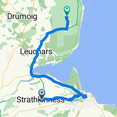
Upper Largo Circuit
A cycling route starting in Strathkinness, Scotland, United Kingdom.
Overview
About this route
- -:--
- Duration
- 37 km
- Distance
- ---
- Ascent
- ---
- Descent
- ---
- Avg. speed
- ---
- Max. altitude
Route quality
Waytypes & surfaces along the route
Waytypes
Road
14.4 km
(39 %)
Quiet road
11.5 km
(31 %)
Undefined
11.1 km
(30 %)
Surfaces
Paved
21.8 km
(59 %)
Asphalt
21.8 km
(59 %)
Undefined
15.2 km
(41 %)
Continue with Bikemap
Use, edit, or download this cycling route
You would like to ride Upper Largo Circuit or customize it for your own trip? Here is what you can do with this Bikemap route:
Free features
- Save this route as favorite or in collections
- Copy & plan your own version of this route
- Sync your route with Garmin or Wahoo
Premium features
Free trial for 3 days, or one-time payment. More about Bikemap Premium.
- Navigate this route on iOS & Android
- Export a GPX / KML file of this route
- Create your custom printout (try it for free)
- Download this route for offline navigation
Discover more Premium features.
Get Bikemap PremiumFrom our community
Other popular routes starting in Strathkinness
 Upper Largo Circuit
- Distance
- 37 km
- Ascent
- ---
- Descent
- ---
- Location
- Strathkinness, Scotland, United Kingdom
 Strathkinness loop
- Distance
- 10 km
- Ascent
- 85 m
- Descent
- 88 m
- Location
- Strathkinness, Scotland, United Kingdom
 1 The Pleasance, St. Andrews to St. Andrews Ward, St. Andrews
- Distance
- 5.5 km
- Ascent
- 0 m
- Descent
- 78 m
- Location
- Strathkinness, Scotland, United Kingdom
 draft
draft- Distance
- 21.4 km
- Ascent
- 57 m
- Descent
- 126 m
- Location
- Strathkinness, Scotland, United Kingdom
 Route from 15 Bonfield Park, St Andrews
- Distance
- 16.2 km
- Ascent
- 276 m
- Descent
- 173 m
- Location
- Strathkinness, Scotland, United Kingdom
 02_StAndrews_2016-06-19
- Distance
- 16.9 km
- Ascent
- 47 m
- Descent
- 137 m
- Location
- Strathkinness, Scotland, United Kingdom
 St. Andrews Ward, St. Andrews to 170-172 South St, St. Andrews
- Distance
- 5.8 km
- Ascent
- 16 m
- Descent
- 95 m
- Location
- Strathkinness, Scotland, United Kingdom
 Route to 1 Rose Lane, St Andrews
- Distance
- 3.3 km
- Ascent
- 5 m
- Descent
- 48 m
- Location
- Strathkinness, Scotland, United Kingdom
Open it in the app