

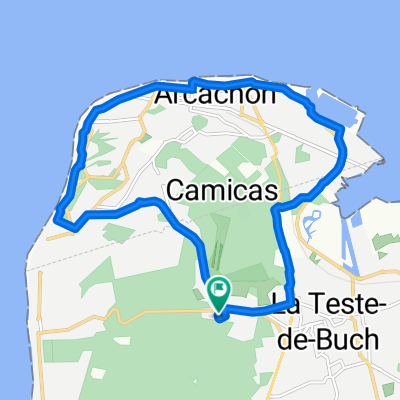
Tour de France 2017 Stage 11
A cycling route starting in Arcachon, Nouvelle-Aquitaine, France.
Overview
About this route
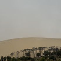
De første 110 km af denne etape køres ude ved Frankrigs smukke vestkyst, derefter drejer de ind i landet, hvor der venter måske sprinternes sidste chance for at få en etapesejr inden Paris
- -:--
- Duration
- 224 km
- Distance
- ---
- Ascent
- ---
- Descent
- ---
- Avg. speed
- ---
- Max. altitude

Route quality
Waytypes & surfaces along the route
Waytypes
Cycleway
85.2 km
(38 %)
Busy road
38.9 km
(17 %)
Surfaces
Paved
110.5 km
(49 %)
Unpaved
16.6 km
(7 %)
Asphalt
103.4 km
(46 %)
Loose gravel
8.5 km
(4 %)
Continue with Bikemap
Use, edit, or download this cycling route
You would like to ride Tour de France 2017 Stage 11 or customize it for your own trip? Here is what you can do with this Bikemap route:
Free features
- Save this route as favorite or in collections
- Copy & plan your own version of this route
- Split it into stages to create a multi-day tour
- Sync your route with Garmin or Wahoo
Premium features
Free trial for 3 days, or one-time payment. More about Bikemap Premium.
- Navigate this route on iOS & Android
- Export a GPX / KML file of this route
- Create your custom printout (try it for free)
- Download this route for offline navigation
Discover more Premium features.
Get Bikemap PremiumFrom our community
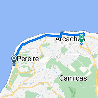
Other popular routes starting in Arcachon
 Rue du Professeur Jolyet, Arcachon a Lège-Cap-Ferret
- Distance
- 70 km
- Ascent
- 237 m
- Descent
- 239 m
- Location
- Arcachon, Nouvelle-Aquitaine, France
 Résidence Arcachon Marine, La Teste-de-Buch a Eurovélo 1 - Atlantique Coast Route, La Teste-de-Buch
- Distance
- 25.5 km
- Ascent
- 187 m
- Descent
- 175 m
- Location
- Arcachon, Nouvelle-Aquitaine, France
 Untitled route
- Distance
- 52 km
- Ascent
- 395 m
- Descent
- 370 m
- Location
- Arcachon, Nouvelle-Aquitaine, France
 De 11 Rue des Portes du Pyla, La Teste-de-Buch à 4 Rue des Portes du Pyla, La Teste-de-Buch
- Distance
- 14.4 km
- Ascent
- 0 m
- Descent
- 6 m
- Location
- Arcachon, Nouvelle-Aquitaine, France
 Arcachon Loop
- Distance
- 75.3 km
- Ascent
- 153 m
- Descent
- 173 m
- Location
- Arcachon, Nouvelle-Aquitaine, France
 De 4 Allée des Souchets, Lège-Cap-Ferret à Allée de la Gélinotte, Lège-Cap-Ferret
- Distance
- 11.3 km
- Ascent
- 3 m
- Descent
- 7 m
- Location
- Arcachon, Nouvelle-Aquitaine, France
 plage -Hotels.com
- Distance
- 3.7 km
- Ascent
- 12 m
- Descent
- 8 m
- Location
- Arcachon, Nouvelle-Aquitaine, France
 Arcachon – Marcheprime - Andernos les Bains - Arcachon
- Distance
- 99 km
- Ascent
- 77 m
- Descent
- 70 m
- Location
- Arcachon, Nouvelle-Aquitaine, France
Open it in the app