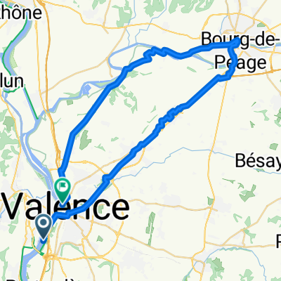
Tour de France 2017 Stage 17
A cycling route starting in Guilherand-Granges, Auvergne-Rh么ne-Alpes, France.
Overview
About this route
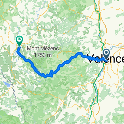
De sidste 45 km vil med garanti kunne bruges til at s忙tte nogle af sine n忙rmeste konkurrenter. De sidste 5 km af Cret Luisard stiger med 16 % i snit, de giver vidst sig selv at man ikke kan k酶re taktisk her. Den sidste nedk酶rsel er ogs氓 rigtig vanskelig og vejen h忙lder ogs氓 med over 10% hele vejen nedad til m氓l. Jeg t酶r ikke g忙tte p氓 en etapevinder her, det kommer an p氓 hvem der har dagen
- -:--
- Duration
- 205.4 km
- Distance
- ---
- Ascent
- ---
- Descent
- ---
- Avg. speed
- ---
- Avg. speed
Continue with Bikemap
Use, edit, or download this cycling route
You would like to ride Tour de France 2017 Stage 17 or customize it for your own trip? Here is what you can do with this Bikemap route:
Free features
- Save this route as favorite or in collections
- Copy & plan your own version of this route
- Sync your route with Garmin or Wahoo
Premium features
Free trial for 3 days, or one-time payment. More about Bikemap Premium.
- Navigate this route on iOS & Android
- Export a GPX / KML file of this route
- Create your custom printout (try it for free)
- Download this route for offline navigation
Discover more Premium features.
Get Bikemap PremiumFrom our community
Other popular routes starting in Guilherand-Granges
- Dia 3 - Valence a Viviers
- Distance
- 80.5 km
- Ascent
- 243 m
- Descent
- 277 m
- Location
- Guilherand-Granges, Auvergne-Rh么ne-Alpes, France
- Valence - Cannes
- Distance
- 442.4 km
- Ascent
- 5,317 m
- Descent
- 5,424 m
- Location
- Guilherand-Granges, Auvergne-Rh么ne-Alpes, France
- 2019 - 5a
- Distance
- 106.7 km
- Ascent
- 486 m
- Descent
- 376 m
- Location
- Guilherand-Granges, Auvergne-Rh么ne-Alpes, France
- Guilherand-Granges, St-Romain-de-Lerps, St P茅ray
- Distance
- 38.9 km
- Ascent
- 723 m
- Descent
- 724 m
- Location
- Guilherand-Granges, Auvergne-Rh么ne-Alpes, France
- Etappe 5
- Distance
- 107.4 km
- Ascent
- 387 m
- Descent
- 366 m
- Location
- Guilherand-Granges, Auvergne-Rh么ne-Alpes, France
- dt Pierre de boeif
- Distance
- 64.8 km
- Ascent
- 141 m
- Descent
- 107 m
- Location
- Guilherand-Granges, Auvergne-Rh么ne-Alpes, France
- droga z Valence do Avignon
- Distance
- 146.3 km
- Ascent
- 449 m
- Descent
- 535 m
- Location
- Guilherand-Granges, Auvergne-Rh么ne-Alpes, France
- Le Tour De France: Stage 9
- Distance
- 200.5 km
- Ascent
- 3,003 m
- Descent
- 2,360 m
- Location
- Guilherand-Granges, Auvergne-Rh么ne-Alpes, France
Open it in the app