

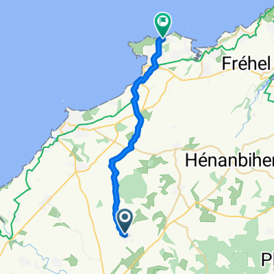
BRETAGNE - lamballe-fréhel-st cast le guildo-plancoet
A cycling route starting in Lamballe, Brittany Region, France.
Overview
About this route
114kms----lamballe - st aaron- la bouillie - "fort la latte" - st cast le guildo - D19 - stlormel - plancoet - bourseul - plorc du arguenon - pléven - plédéliac - st igneuc - D16 - D776 - plestan - D712 - noyal- lamballe
- -:--
- Duration
- 113.7 km
- Distance
- 488 m
- Ascent
- 489 m
- Descent
- ---
- Avg. speed
- ---
- Max. altitude

Route quality
Waytypes & surfaces along the route
Waytypes
Road
51.1 km
(45 %)
Busy road
40.6 km
(36 %)
Surfaces
Paved
44 km
(39 %)
Unpaved
2.1 km
(2 %)
Asphalt
44 km
(39 %)
Gravel
1 km
(<1 %)
Continue with Bikemap
Use, edit, or download this cycling route
You would like to ride BRETAGNE - lamballe-fréhel-st cast le guildo-plancoet or customize it for your own trip? Here is what you can do with this Bikemap route:
Free features
- Save this route as favorite or in collections
- Copy & plan your own version of this route
- Split it into stages to create a multi-day tour
- Sync your route with Garmin or Wahoo
Premium features
Free trial for 3 days, or one-time payment. More about Bikemap Premium.
- Navigate this route on iOS & Android
- Export a GPX / KML file of this route
- Create your custom printout (try it for free)
- Download this route for offline navigation
Discover more Premium features.
Get Bikemap PremiumFrom our community
Other popular routes starting in Lamballe
 Itinéraire à partir de 3 Rue des Cyprès, Lamballe-Armor
- Distance
- 19.2 km
- Ascent
- 143 m
- Descent
- 209 m
- Location
- Lamballe, Brittany Region, France
 BRETAGNE - lamballe-henon-ploeuc sur lie-plouguenast-
- Distance
- 80.4 km
- Ascent
- 575 m
- Descent
- 573 m
- Location
- Lamballe, Brittany Region, France
 Lamballe to Saint-Quay-Portrieux
- Distance
- 44.5 km
- Ascent
- 419 m
- Descent
- 447 m
- Location
- Lamballe, Brittany Region, France
 52 Rue de la Guignardais, Lamballe à 45 Rue de la Guignardais, Lamballe
- Distance
- 29.8 km
- Ascent
- 217 m
- Descent
- 216 m
- Location
- Lamballe, Brittany Region, France
 BRETAGNE - lamballe-fréhel-st cast le guildo-plancoet
- Distance
- 113.7 km
- Ascent
- 488 m
- Descent
- 489 m
- Location
- Lamballe, Brittany Region, France
 RSQ_2020_7.Etappe
- Distance
- 170.3 km
- Ascent
- 908 m
- Descent
- 948 m
- Location
- Lamballe, Brittany Region, France
 BRETAGNE - lamballe-jugon les lacs-collinée
- Distance
- 100.3 km
- Ascent
- 668 m
- Descent
- 668 m
- Location
- Lamballe, Brittany Region, France
 BRETAGNE - lamballe-st carreux-plédran-iffiniac-le val andré
- Distance
- 67.6 km
- Ascent
- 470 m
- Descent
- 464 m
- Location
- Lamballe, Brittany Region, France
Open it in the app