

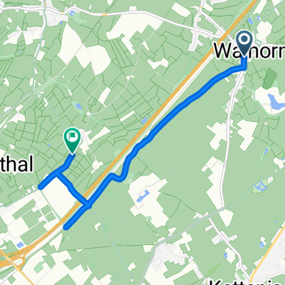
Lontzen Talsperre Eupen
A cycling route starting in Lontzen, Wallonia, Belgium.
Overview
About this route
Meadow landscape and forest trails around the dam. Break at the dam restaurant
- -:--
- Duration
- 41.8 km
- Distance
- 371 m
- Ascent
- 372 m
- Descent
- ---
- Avg. speed
- ---
- Max. altitude

Continue with Bikemap
Use, edit, or download this cycling route
You would like to ride Lontzen Talsperre Eupen or customize it for your own trip? Here is what you can do with this Bikemap route:
Free features
- Save this route as favorite or in collections
- Copy & plan your own version of this route
- Sync your route with Garmin or Wahoo
Premium features
Free trial for 3 days, or one-time payment. More about Bikemap Premium.
- Navigate this route on iOS & Android
- Export a GPX / KML file of this route
- Create your custom printout (try it for free)
- Download this route for offline navigation
Discover more Premium features.
Get Bikemap PremiumFrom our community
Other popular routes starting in Lontzen
 Venn2
Venn2- Distance
- 76.3 km
- Ascent
- 682 m
- Descent
- 685 m
- Location
- Lontzen, Wallonia, Belgium
 Walhorn-Sandstr-7Weier-PresterUrwald
- Distance
- 6.1 km
- Ascent
- 58 m
- Descent
- 79 m
- Location
- Lontzen, Wallonia, Belgium
 Trasa do ?‰???
- Distance
- 5.9 km
- Ascent
- 45 m
- Descent
- 66 m
- Location
- Lontzen, Wallonia, Belgium
 Walhorn-Eynatten-Hauset-Göhl-7Weiher
- Distance
- 10.8 km
- Ascent
- 112 m
- Descent
- 138 m
- Location
- Lontzen, Wallonia, Belgium
 Lac de la Gileppe
- Distance
- 37.8 km
- Ascent
- 366 m
- Descent
- 363 m
- Location
- Lontzen, Wallonia, Belgium
 Hoge Venen - Ruhreifel 2
- Distance
- 105.9 km
- Ascent
- 1,049 m
- Descent
- 1,046 m
- Location
- Lontzen, Wallonia, Belgium
 Radwegeverbindungen Walhorn-Herbesthal
- Distance
- 5.6 km
- Ascent
- 26 m
- Descent
- 18 m
- Location
- Lontzen, Wallonia, Belgium
 Lontzen Talsperre Eupen
- Distance
- 41.8 km
- Ascent
- 371 m
- Descent
- 372 m
- Location
- Lontzen, Wallonia, Belgium
Open it in the app