

טל שחר - מודיעין והאזור
A cycling route starting in Mazkeret Batya, Central District, Israel.
Overview
About this route
אורך:60 ק"מ
גובה: 500 מטר
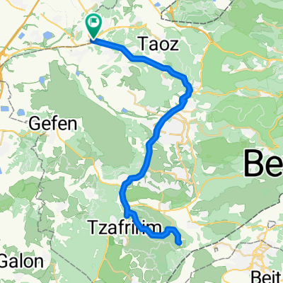
תאור: טל שחר, כביש3, נווה שלום, לטרון, מודיעין, 443, קפה בשילת, 443 , לוד, מחלף רמלוד, כביש 44, צומת נחשון, טל שחר.
- -:--
- Duration
- 59.6 km
- Distance
- 441 m
- Ascent
- 438 m
- Descent
- ---
- Avg. speed
- ---
- Max. altitude

Continue with Bikemap
Use, edit, or download this cycling route
You would like to ride טל שחר - מודיעין והאזור or customize it for your own trip? Here is what you can do with this Bikemap route:
Free features
- Save this route as favorite or in collections
- Copy & plan your own version of this route
- Sync your route with Garmin or Wahoo
Premium features
Free trial for 3 days, or one-time payment. More about Bikemap Premium.
- Navigate this route on iOS & Android
- Export a GPX / KML file of this route
- Create your custom printout (try it for free)
- Download this route for offline navigation
Discover more Premium features.
Get Bikemap PremiumFrom our community
Other popular routes starting in Mazkeret Batya
 tsuba plus
- Distance
- 94.1 km
- Ascent
- 1,068 m
- Descent
- 1,068 m
- Location
- Mazkeret Batya, Central District, Israel
 בית הרצל בן נון משמר דוד
- Distance
- 29.4 km
- Ascent
- 304 m
- Descent
- 304 m
- Location
- Mazkeret Batya, Central District, Israel
 Forest to Mishmar Ayalon
- Distance
- 16.7 km
- Ascent
- 236 m
- Descent
- 238 m
- Location
- Mazkeret Batya, Central District, Israel
 המגינים, נחשון, תל גזר
- Distance
- 18.9 km
- Ascent
- 266 m
- Descent
- 260 m
- Location
- Mazkeret Batya, Central District, Israel
 סובב רחובות
- Distance
- 27.8 km
- Ascent
- 191 m
- Descent
- 155 m
- Location
- Mazkeret Batya, Central District, Israel
 מזכרת בתיה - מודיעין מעגלי
- Distance
- 59.5 km
- Ascent
- 427 m
- Descent
- 427 m
- Location
- Mazkeret Batya, Central District, Israel
 Nachshon Junction to Nachshon Junction
- Distance
- 62.3 km
- Ascent
- 790 m
- Descent
- 791 m
- Location
- Mazkeret Batya, Central District, Israel
 מרובע: נחשון - שמשון - תל עזקה - ראם - נחשון
- Distance
- 54.1 km
- Ascent
- 492 m
- Descent
- 493 m
- Location
- Mazkeret Batya, Central District, Israel
Open it in the app