

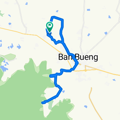
J084 – Jeudi 30 mars 2017 Ban Bueng – Ban Tin Pet (intersection routes 365 – 315 – 304)
A cycling route starting in Ban Bueng, Chon Buri, Thailand.
Overview
About this route
J084 – Thursday, March 30, 2017
Ban Bueng – Ban Tin Pet (intersection of routes 365 – 315 – 304)
Despite changing the battery, the odometer has not displayed anything since this morning. The data below is therefore from the GPS (smartphone for distance, average speed, and altitudes; and from Bikemap for elevation gain. There are no slope percentages on Bikemap, but that is of no importance today as the route was almost flat.
47.99 km – Average speed: 14.6 km/h
Elevation gain: 0 m - Elevation loss: 60 m.
Starting altitude: 73 m – Finishing altitude: 2 m – Maximum altitude: 73 m.
- -:--
- Duration
- 48.1 km
- Distance
- 10 m
- Ascent
- 75 m
- Descent
- ---
- Avg. speed
- ---
- Max. altitude
Route quality
Waytypes & surfaces along the route
Waytypes
Road
14.4 km
(30 %)
Quiet road
4.8 km
(10 %)
Continue with Bikemap
Use, edit, or download this cycling route
You would like to ride J084 – Jeudi 30 mars 2017 Ban Bueng – Ban Tin Pet (intersection routes 365 – 315 – 304) or customize it for your own trip? Here is what you can do with this Bikemap route:
Free features
- Save this route as favorite or in collections
- Copy & plan your own version of this route
- Sync your route with Garmin or Wahoo
Premium features
Free trial for 3 days, or one-time payment. More about Bikemap Premium.
- Navigate this route on iOS & Android
- Export a GPX / KML file of this route
- Create your custom printout (try it for free)
- Download this route for offline navigation
Discover more Premium features.
Get Bikemap PremiumFrom our community
Other popular routes starting in Ban Bueng
 TTOH Day 1
- Distance
- 60.1 km
- Ascent
- 233 m
- Descent
- 226 m
- Location
- Ban Bueng, Chon Buri, Thailand
 Cracking ride in Amphoe Ban Bueng
- Distance
- 20.8 km
- Ascent
- 109 m
- Descent
- 109 m
- Location
- Ban Bueng, Chon Buri, Thailand
 Restful route in Amphoe Ban Bueng
- Distance
- 30 km
- Ascent
- 195 m
- Descent
- 196 m
- Location
- Ban Bueng, Chon Buri, Thailand
 Relaxed route in Amphoe Ban Bueng
- Distance
- 28.4 km
- Ascent
- 296 m
- Descent
- 295 m
- Location
- Ban Bueng, Chon Buri, Thailand
 Steady ride in Pathum Rat
- Distance
- 32.2 km
- Ascent
- 183 m
- Descent
- 183 m
- Location
- Ban Bueng, Chon Buri, Thailand
 05-01-2016
- Distance
- 12.4 km
- Ascent
- 22 m
- Descent
- 21 m
- Location
- Ban Bueng, Chon Buri, Thailand
 Recovered Route
- Distance
- 33.9 km
- Ascent
- 46 m
- Descent
- 45 m
- Location
- Ban Bueng, Chon Buri, Thailand
 J084 – Jeudi 30 mars 2017 Ban Bueng – Ban Tin Pet (intersection routes 365 – 315 – 304)
- Distance
- 48.1 km
- Ascent
- 10 m
- Descent
- 75 m
- Location
- Ban Bueng, Chon Buri, Thailand
Open it in the app