

J085 – Vendredi 31 mars 2017 Ban Tin Pet – Lat Krabang
A cycling route starting in Chachoengsao, Chachoengsao, Thailand.
Overview
About this route
J085 – Friday, March 31, 2017
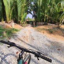
Ban Tin Pet – Lat Krabang
42.27 Km – Average speed: 14.68 Km/h
Elevation gain: 75 m - Elevation loss: 77 m.
Maximum uphill gradient: 6 % - Maximum downhill gradient: 4 % (almost flat route, the climbs and descents are crossings over watercourses or roads)
Start altitude: 2 m – Finish altitude: 0 m – Maximum altitude: 13 m.
- -:--
- Duration
- 41.7 km
- Distance
- 10 m
- Ascent
- 8 m
- Descent
- ---
- Avg. speed
- ---
- Max. altitude
Route quality
Waytypes & surfaces along the route
Waytypes
Quiet road
7.9 km
(19 %)
Cycleway
3.8 km
(9 %)
Surfaces
Paved
7.9 km
(19 %)
Asphalt
3.3 km
(8 %)
Paved (undefined)
2.9 km
(7 %)
Continue with Bikemap
Use, edit, or download this cycling route
You would like to ride J085 – Vendredi 31 mars 2017 Ban Tin Pet – Lat Krabang or customize it for your own trip? Here is what you can do with this Bikemap route:
Free features
- Save this route as favorite or in collections
- Copy & plan your own version of this route
- Sync your route with Garmin or Wahoo
Premium features
Free trial for 3 days, or one-time payment. More about Bikemap Premium.
- Navigate this route on iOS & Android
- Export a GPX / KML file of this route
- Create your custom printout (try it for free)
- Download this route for offline navigation
Discover more Premium features.
Get Bikemap PremiumFrom our community
Other popular routes starting in Chachoengsao
 J085 – Vendredi 31 mars 2017 Ban Tin Pet – Lat Krabang
- Distance
- 41.7 km
- Ascent
- 10 m
- Descent
- 8 m
- Location
- Chachoengsao, Chachoengsao, Thailand
 KMOT training day
- Distance
- 129.6 km
- Ascent
- 51 m
- Descent
- 48 m
- Location
- Chachoengsao, Chachoengsao, Thailand
 murrah farm in the rain (219 km)
- Distance
- 172.2 km
- Ascent
- 112 m
- Descent
- 114 m
- Location
- Chachoengsao, Chachoengsao, Thailand
 Unnamed Road, ตำบล บางแก้ว to Unnamed Road, ตำบล บางแก้ว
- Distance
- 201 km
- Ascent
- 801 m
- Descent
- 806 m
- Location
- Chachoengsao, Chachoengsao, Thailand
 1020 Thep Khunakon 8/2, Mueang Chachoengsao to Chunlanan, Mueang Chachoengsao
- Distance
- 3.5 km
- Ascent
- 4 m
- Descent
- 4 m
- Location
- Chachoengsao, Chachoengsao, Thailand
 От Unnamed Road, Tambon Bang Tin Pet до Unnamed Road, Tambon Bang Tin Pet
- Distance
- 15.4 km
- Ascent
- 98 m
- Descent
- 98 m
- Location
- Chachoengsao, Chachoengsao, Thailand
 130110-Prachinburi
- Distance
- 73.7 km
- Ascent
- 22 m
- Descent
- 21 m
- Location
- Chachoengsao, Chachoengsao, Thailand
 chachoengsao trip
- Distance
- 50.7 km
- Ascent
- 29 m
- Descent
- 27 m
- Location
- Chachoengsao, Chachoengsao, Thailand
Open it in the app